The Return of the Trees – Stabilizing the Landscape Through Changes in Energy Demand
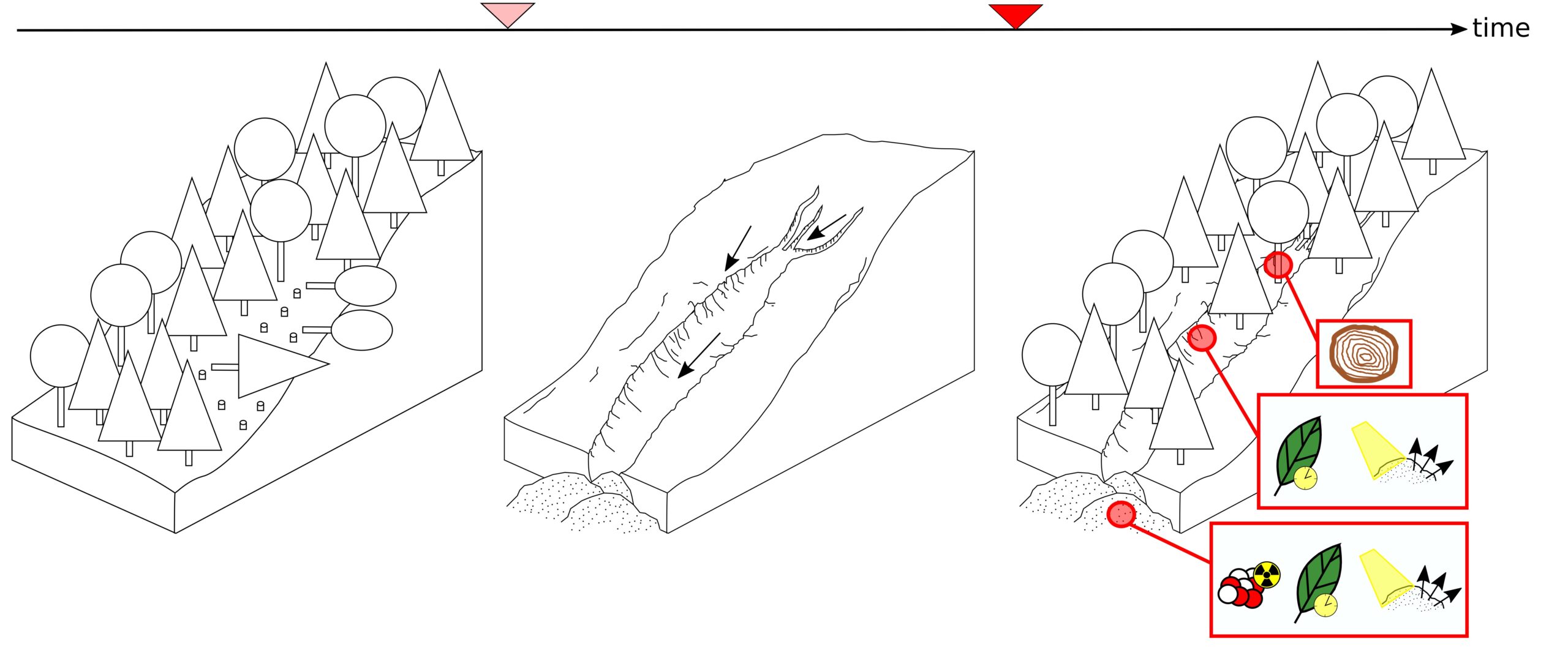
Return of the Trees 04 (Lea Schönleber)
Deeply incised erosion channels are common features in upland areas. This project aims to investigate whether these—now inactive—channel systems formed due to erosion processes that occurred during the Late Middle Ages and the Early Modern Period. At that time, many slopes were clearcut to provide firewood for brine evaporation or ore extraction. Presumably, the resulting bare slopes were immediately exposed to severe erosion. This process only stopped once tree growth and reforestation stabilized the slopes. The current erosion activity in the forest gullies is considered to be low.
This project uses historical, geomorphological, geochronological, and dendrochronological approaches to quantify landscape dynamics and links economic change with environmental dynamics. Our goal is to determine when and through which processes the gullies formed, and how much sediment was eroded. We are particularly interested in the timing of gully stabilization and how long this stabilization phase lasted. In carefully selected watersheds for which historical data is available, we aim to identify erosion landforms and their deposition traces and analyze them.
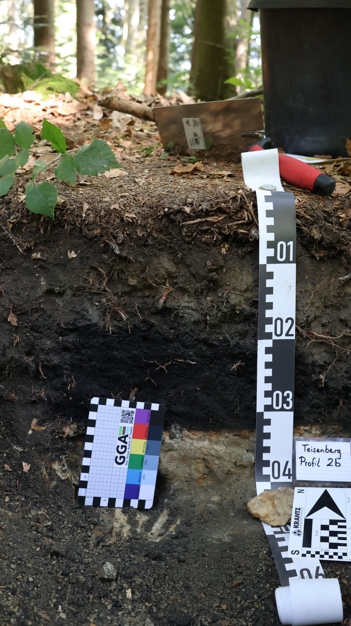
Teisenberg Profil 2b (Lea Schönleber)
Integrating these various methods makes it possible to quantify the stabilization of the landscape following the massive changes in energy demand and fuel economy and to provide reliable timescales for post-disturbance woodland recovery.
-
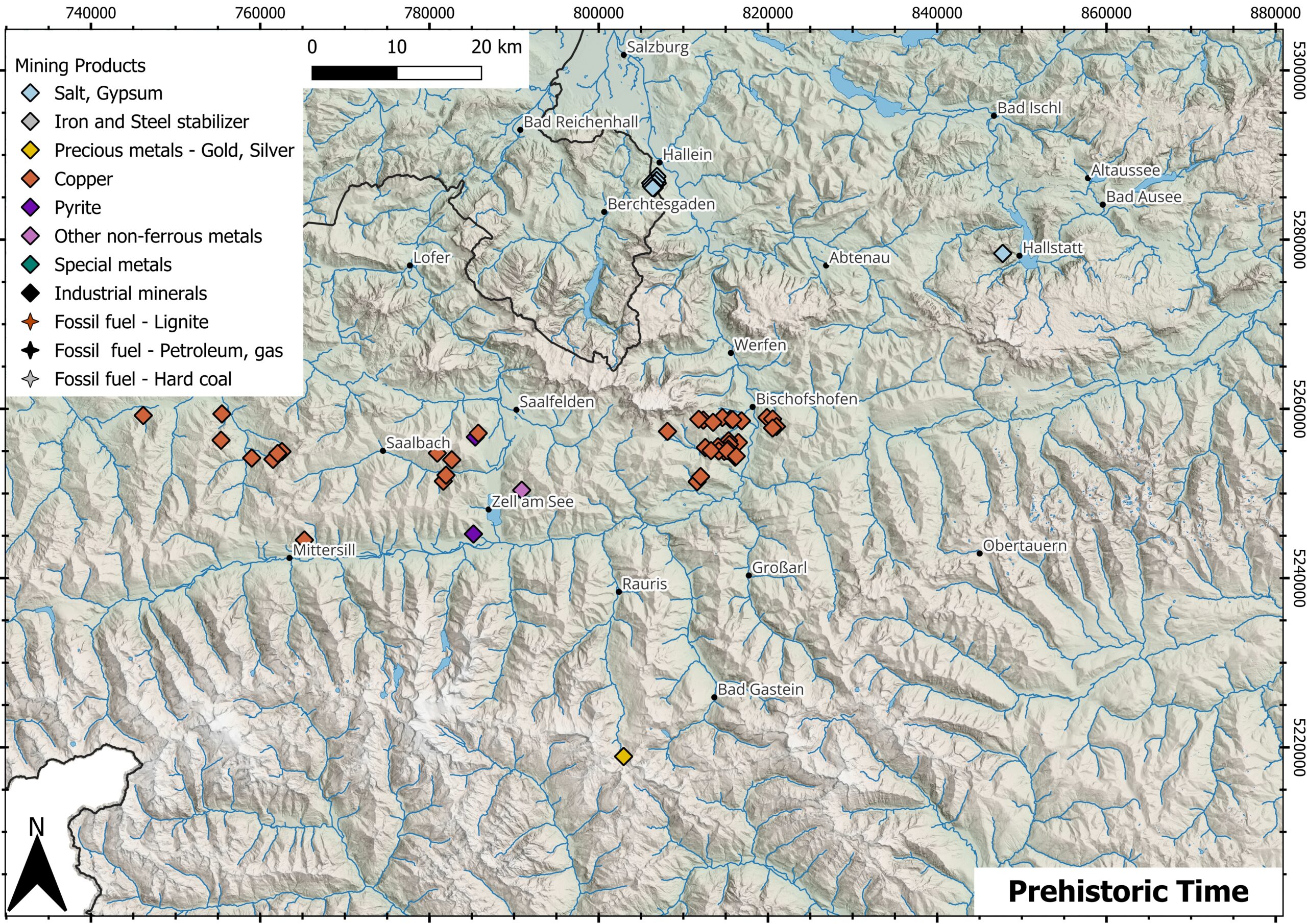
Mining Products Prehistoric Time -
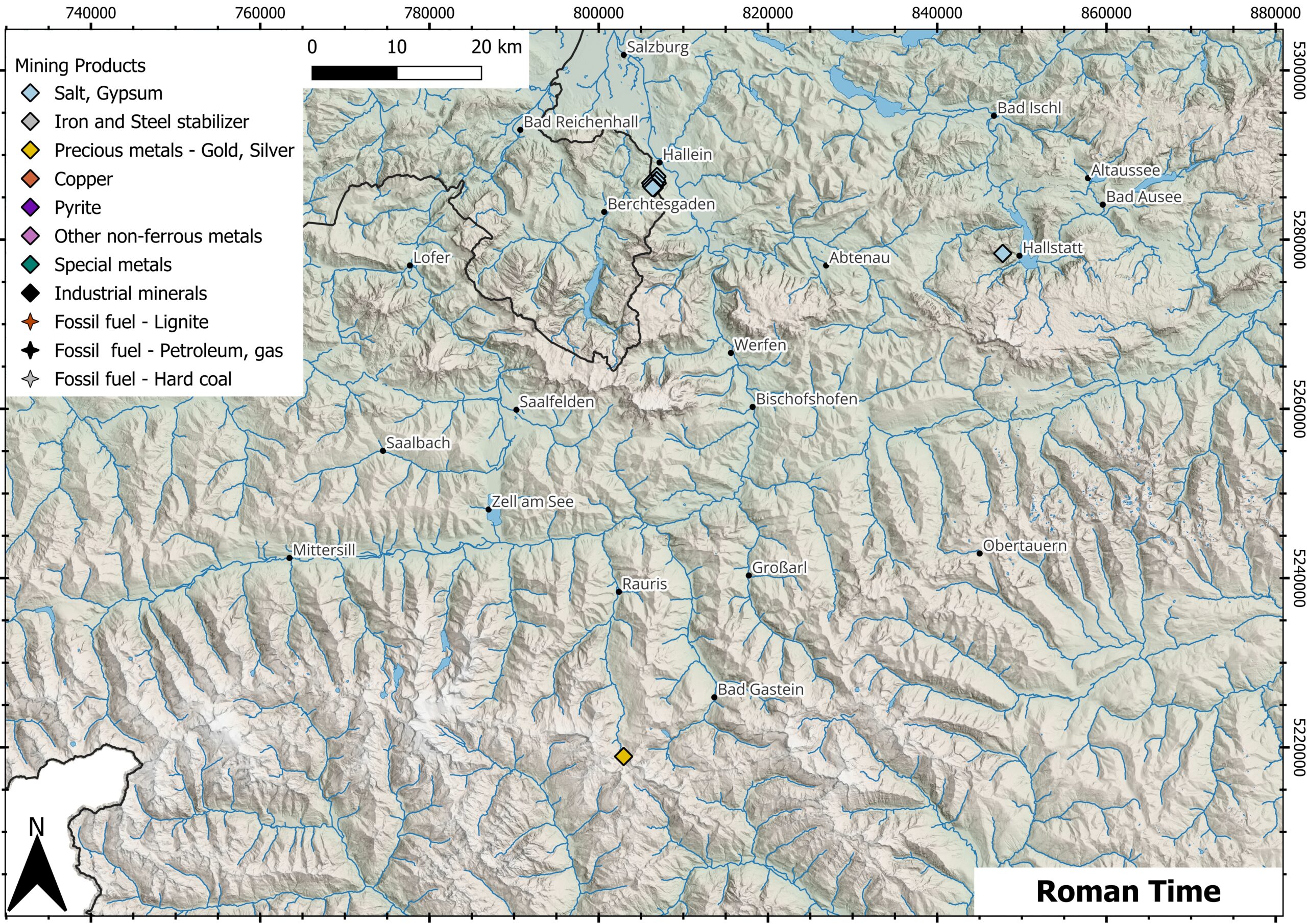
Mining Products Roman Time -
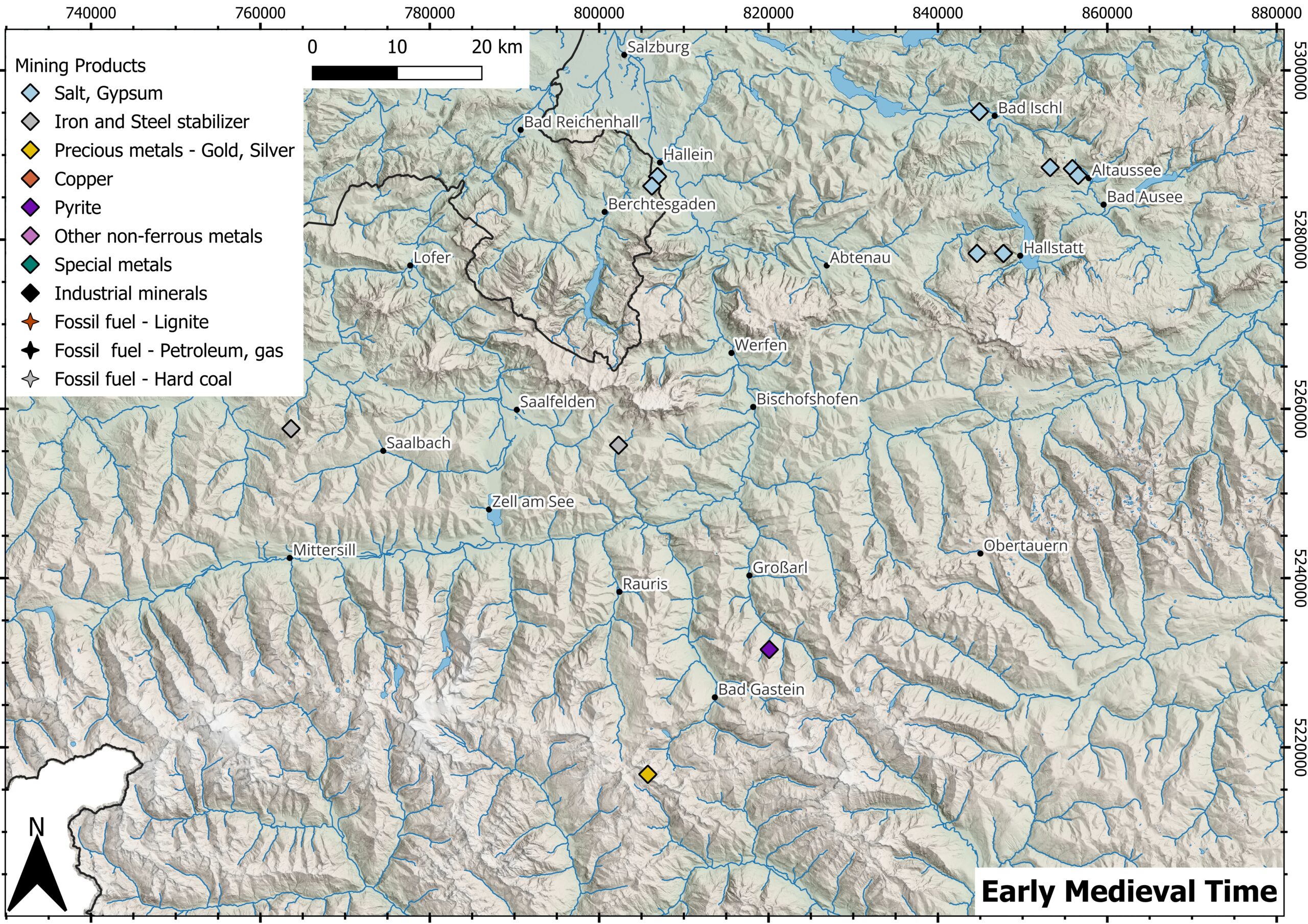
Mining Products Early Medieval Time -
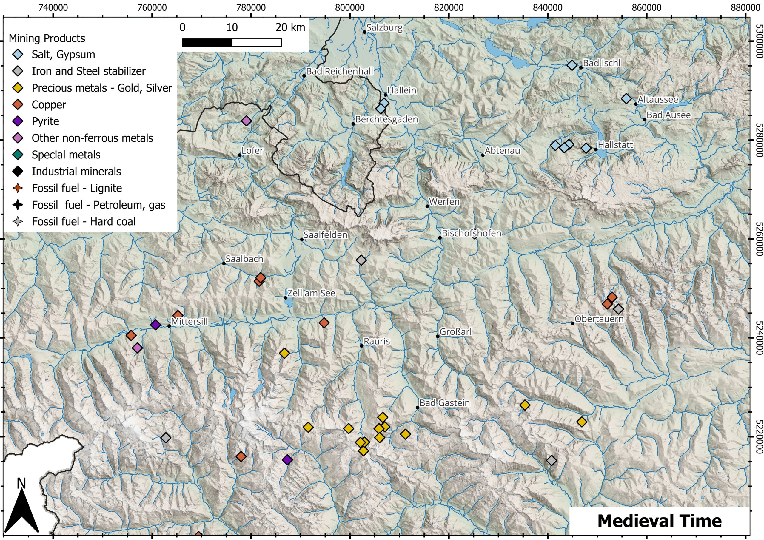
Mining Products Medieval Time -
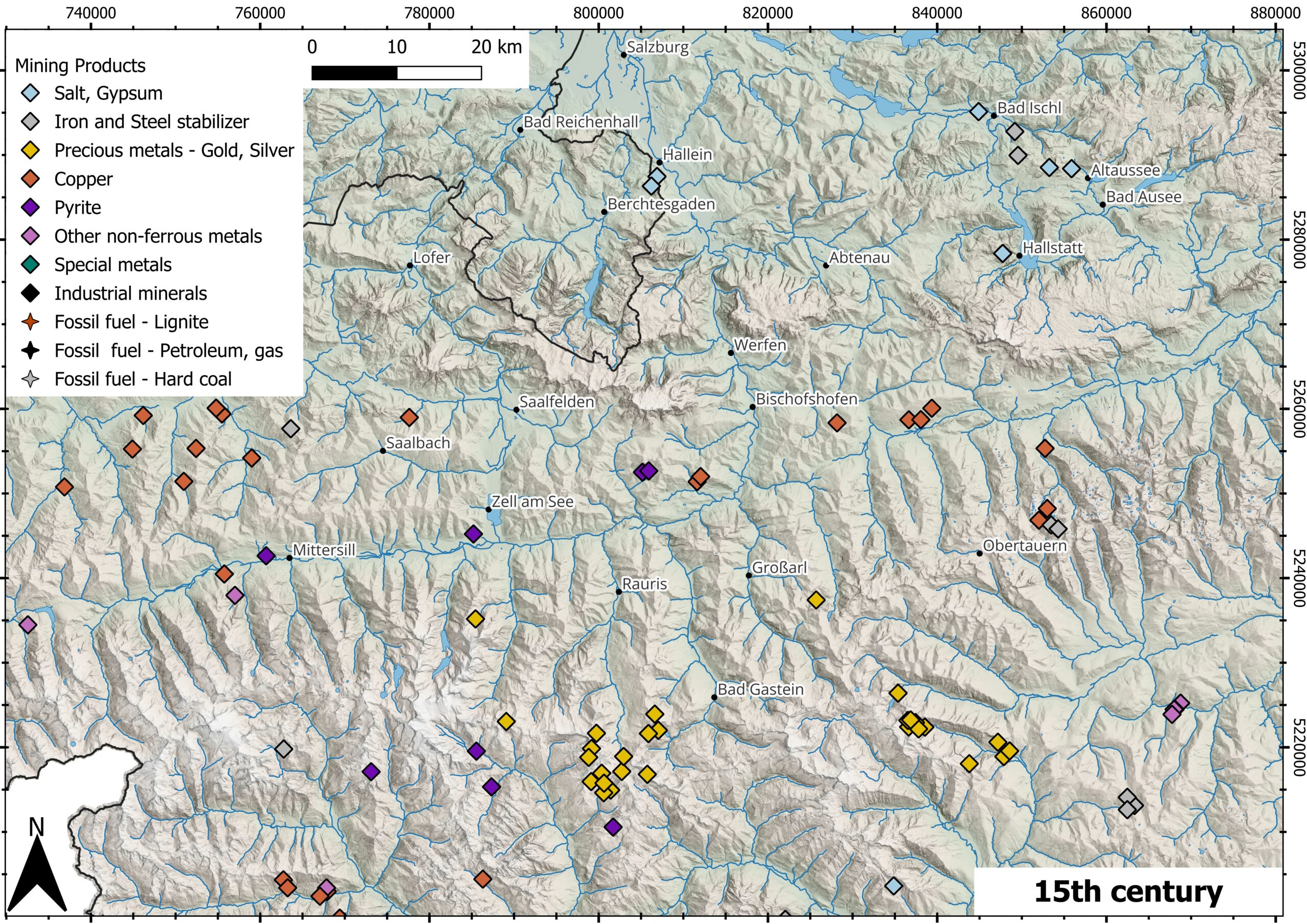
Mining Products 15th century -
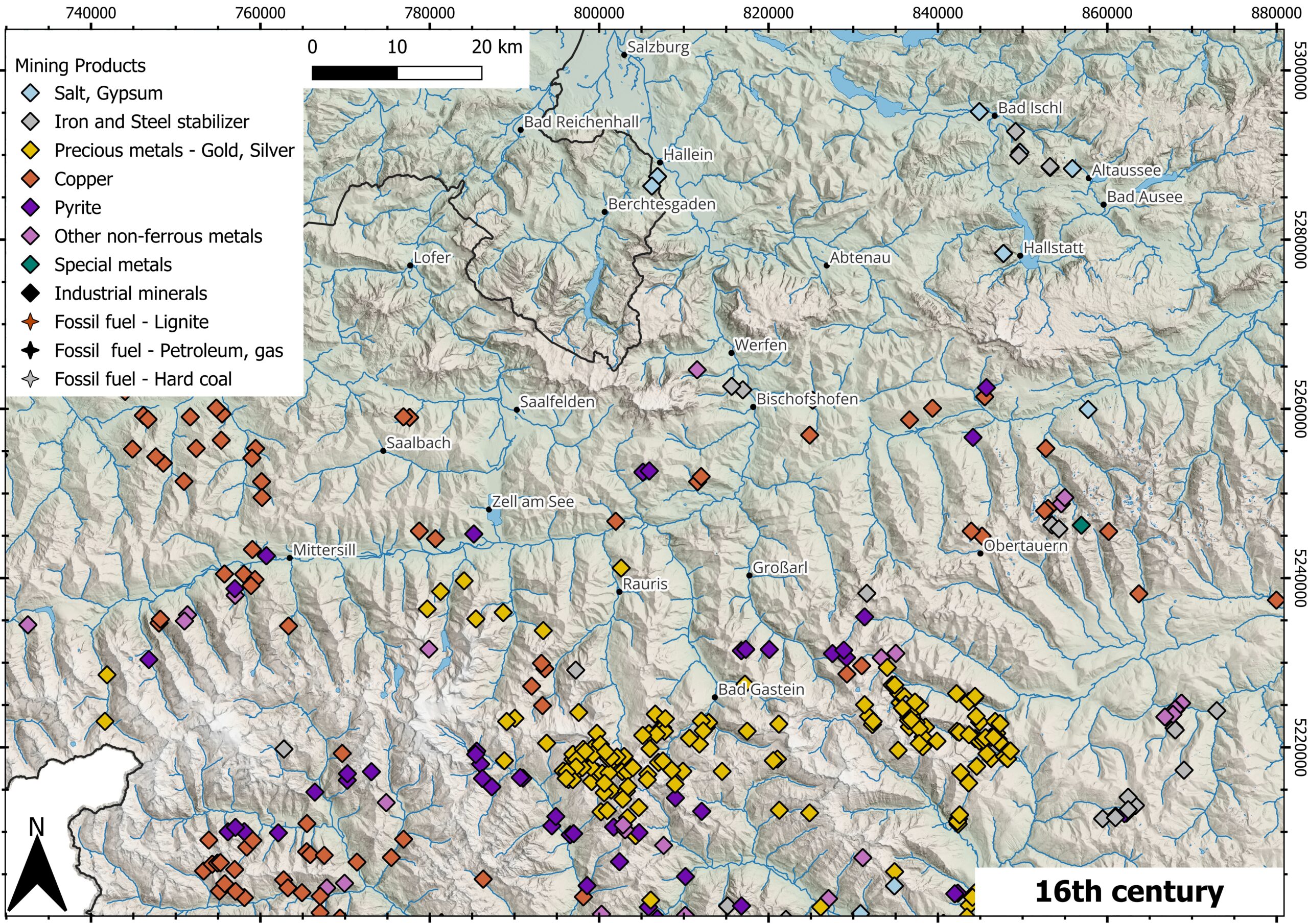
Mining Products 16th century -
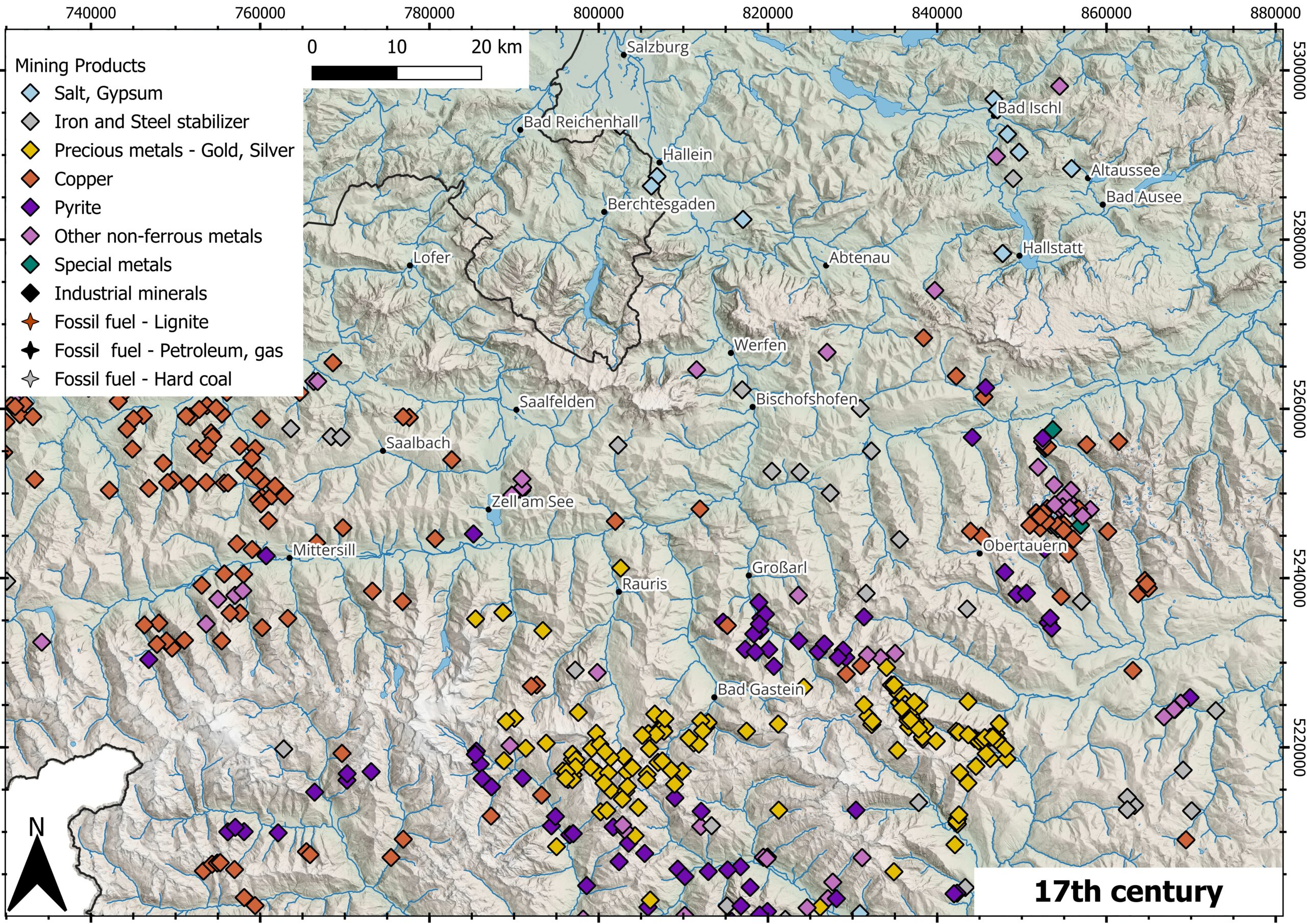
Mining Products 17th century -
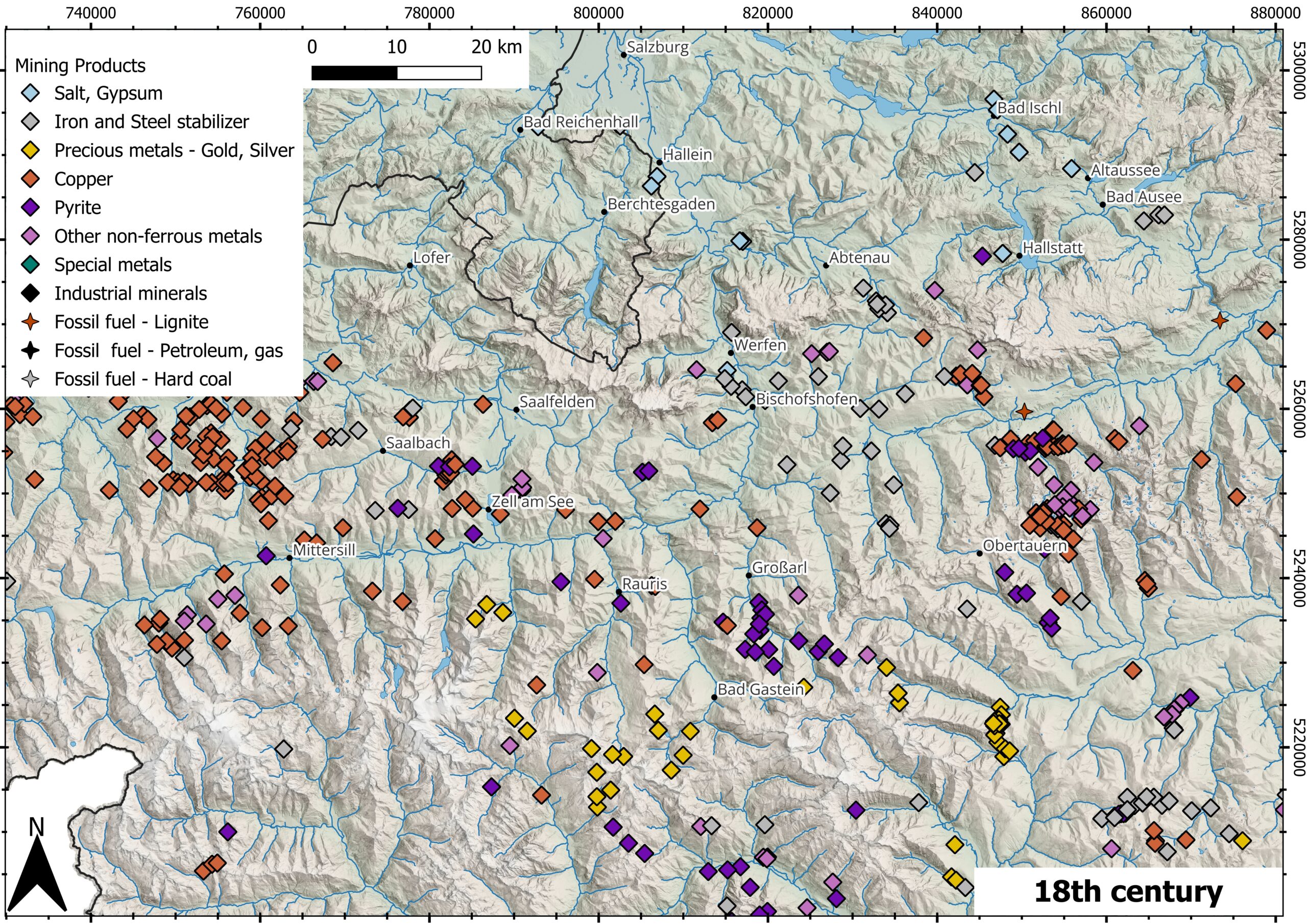
Mining Products 18th century -
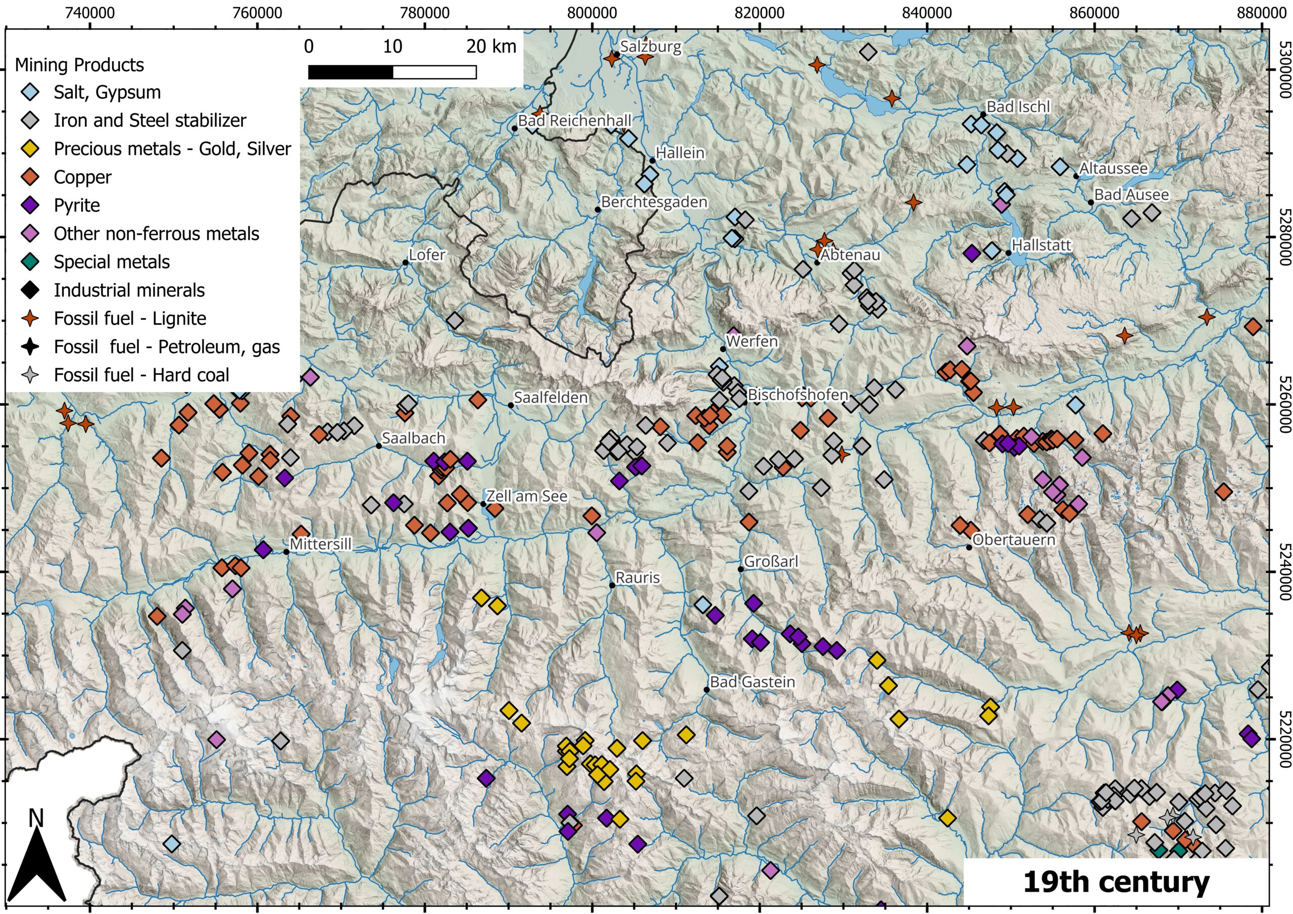
Mining Products 19th century -
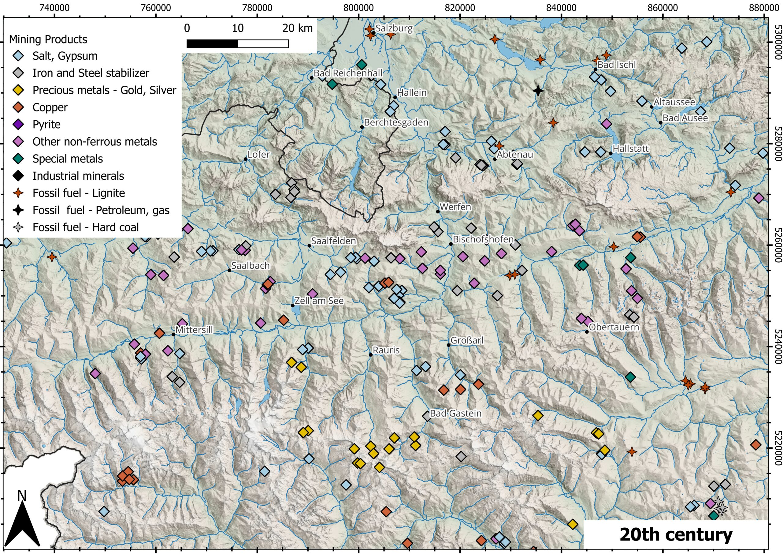
Mining Products 20th century -
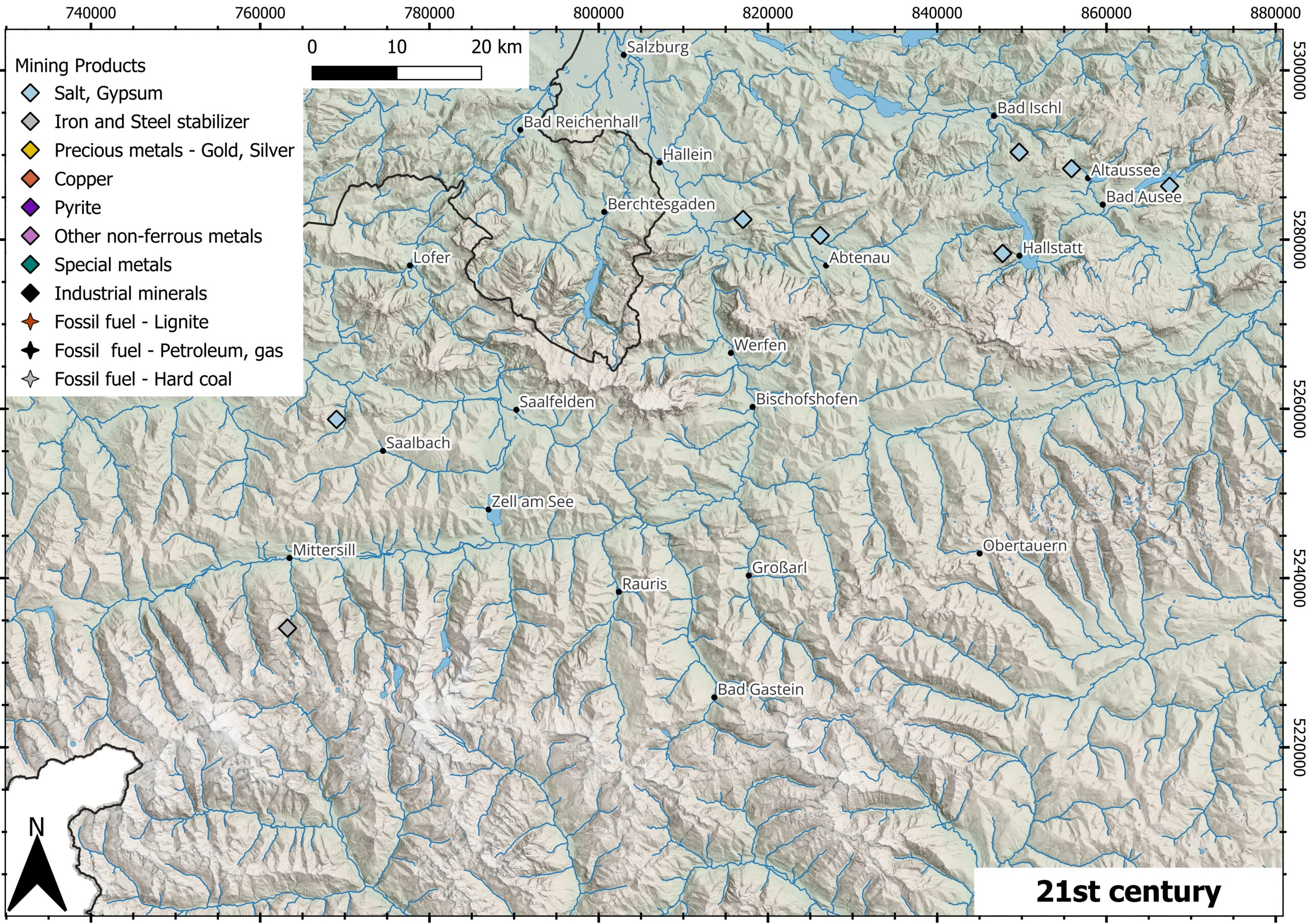
Mining Products 21th century
Caption: Map by Lea Schönleber featuring data from GeoSphere Austria, Mining Activity, and IRIS (Interactive Resource Information System)
Team:
Lea Schönleber (PhD-student) – is a geographer and geologist and has been working on her doctoral dissertation at the University of Salzburg since November 2025.
Andreas Lang (Supervisors) – is a professor of geography specializing in geomorphology and investigates various aspects of historical landscape development. He is an expert in dating past processes.
Martin Knoll – is a professor of European regional history. His research focuses, among other things, on environmental and cultural history, with a particular emphasis on processes of regional change in society, the economy, and the environment.
Jan-Christoph Otto – is an associate professor of geography specializing in geomorphology. His research focuses on the current and past effects of climate and environmental change on landscapes.
If there are any question to this topic you are welcome to send me an E-Mail: