FOR APAC Lecture Series Agorá
“Imaginary Cosmography Revival in Late Joseon Korea: Circular World Maps and Their Early Chinese Sources”
Prof. Dr. Vera Dorofeeva-Lichtmann | EHESS, Paris – MPIWG, Berlin
Freitag, 5. April 2024 | 14:15-15:45 Uhr | Universitätsplatz 1, HS 107
Zum Vortrag (in Englisch)
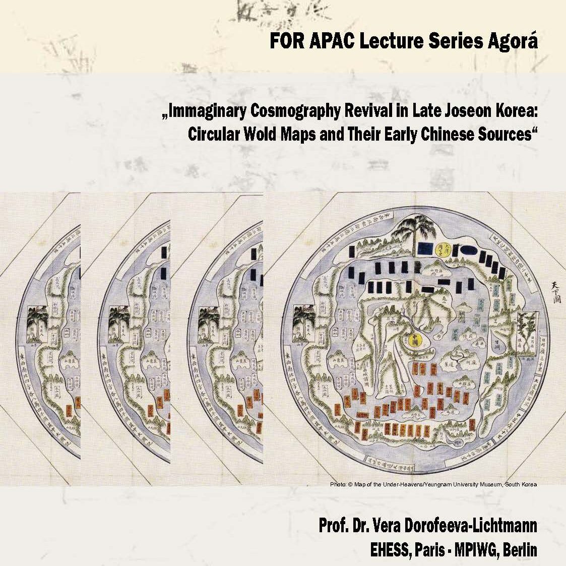
The “Maps of the Under-Heavens” (天下圖 Korean Cheonhado, Chinese Tianxiatu 天下) shaped as a nest of concentric zones inscribed into a circle are a cartographical puzzle in many ways. These maps serve as key maps in popular atlases which became outstandingly widespread in late Joseon Korea (18th-19th centuries). The circular world maps are the first and the only extant cartographic representations of the famous early Chinese description of the entire inhabited world, which is translated as the “Classic or Itineraries of Mountains and Seas” (Shanhaijing 山海經, compiled about the 1st century BC). Considerable time gaps between a source geographical text and the attempts to represent information derived from it as maps are rather common in the history of cartography. Ptolemaeic maps, as well as mediaeval mappaemundi provide good illustrations of this phenomenon. The Korean circular world maps are typologically similar to the mediaeval mappaemundi, and this is how the former are referred to in their first studies in order to facilitate comprehension of their nature for Western scholars (Rosetti 1905, Nakamura 1947). Both are schematic representations of the world aimed to convey a certain conceptual organisation of space, without much concern for accuracy. There is, however, one substantial difference: one can hardly imagine a wide circulation of mediaeval mappaemundi-type of maps in late modern Europe, when mathematical cartography became completely dominant. In contrast, the confusingly archaic and simplistic maps of the popular Korean atlases, including the circular world maps, continued to be produced and reproduced in an almost unchanged form, not matching the mainstream of modern cartography and insensible to its development, what apparently was one of the reasons of their popularity.
A revival of interest in imaginary cosmography occurred about a century earlier in China where appeared ‘cosmograph’-tailoured maps, which convey the symbolism of the square earth inscribed into the round heavens. These maps usually entitled “Maps of Established Positions of Heavens and Earth” (Tian Di ding wei zhi tu 天地定位之圖) are found in Chinese compendiums on divination dating from the early 17th century onwards. I shall try to demonstrate that the Korean circular maps have a close affinity with these ‘cosmograph’ maps, which, in their turn have structural parallels with the early Chinese divination boards – ‘cosmographs’ (shipan 式盤) and especially the diviner’s bronze mirrors. This allows one to see the shape of the circular world maps in a new light – not as an attempt to match it to the image of the round earth, diffused together with the Western cartography, as it is often explained, but as a symbolic representation of the heavenly circle, encompassing the terrestrial surface. The title of the maps can then be seen as referring to this cosmological idea. It should be noted that the Korean cartographical tradition favoured circular configurations.
- Mehr Informationen zu Prof. Dorofeeva-Lichtmann finden Sie hier und hier.
- Lesen Sie mehr auf FOR APAC LECTURE SERIES AGORÁ.


