APPLIED GEOINFORMATICS, MASTER’S PROGRAMME
| Apply now |  |
| Course Duration / ECTS | 4 semesters / 120 ECTS |
| University degree | Master of Science (MSc) |
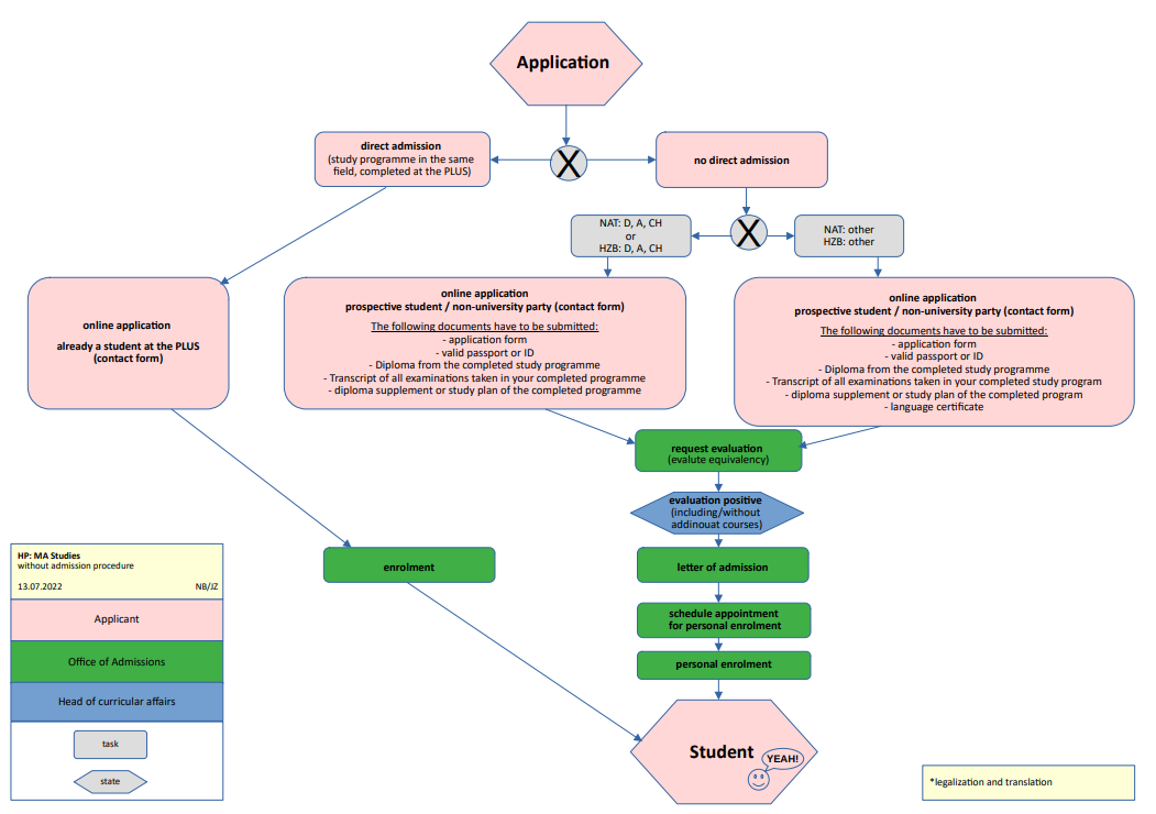
| Admission Requirements and Curriculum | · Bachelor level graduates from ‘spatially oriented disciplines’ like Geography, Surveying / Geomatics, Geoinformatics or Cartography can be admitted without additional coursework. Candidates with a bachelor level or higher qualification in other relevant fields like computer science, ecology, geosciences, environmental sciences, social sciences of economics can be ‘conditionally’ admitted with additional credit requirements of up to 45 ECTS. · Curriculum |
| Language level required | English C1 |
| Dates and Deadlines | · The dates and deadlines change every semester. · The current deadlines and dates can be found here. |
| Information on the department | Department of Geoinformatics – Z_GIS |
Are you already a student at the PLUS and want to take up this study program as well – or switch? Please contact the Office of Admissions via the link below.
If you still need help or advice after enrolling (registering for a study program), you will find important links here.

What will I learn?
The knowledge and skills developed in this programme are based on the common grounding of spatial sciences and a ‘Digital Earth’ perspective, based on concepts typically acquired during undergraduate Geography, Surveying, Environmental Studies, Cartography or Planning programmes. The MSc aims at building of advanced competences in geospatial data acquisition and data management, data analytics and simulation as well as interactive communication. Graduates are expected to interface with different spatially oriented application domains, contribute to solving problems across societies, economies and environments as well as leading teams assigned pertinent tasks.

What makes Salzburg so special as a place to study?
The Department of Geoinformatics – Z_GIS at the University of Salzburg is a recognized Centre of Excellence established since the late 1980ies and provides the competence and capacity for offering a high level of undergraduate and postgraduate education. The residential MSc programme in Applied Geoinformatics is managed by Z_GIS as a core component of its academic qualifications in Geoinformatics and Geographic Information Science. The excellent support of students is a special feature, we translate research into education. A compulsory internship brings added value and links with potential employment opportunities in a relevant sector.

Which career opportunities do I have?
Graduates of the Master’s programme in "Applied Geoinformatics" develop a focus on methodological and technical areas of expertise, thus emphasizing career perspectives in public administration (e.g. spatial data infrastructures and Geoinformatics services and application development, as well as in application domains such as in spatial planning, regional management, mobility, environment and nature conservation) and in business across a broad spectrumof industries. The study programme covers all areas of geospatial data collection and data management, spatial analytics, communication of results and decision support, interaction with of spatial information, as well as aspects of general management.
Doctoral Programme at the Faculty of Digital and Analytical Sciences
PhD Geoinformatics
Contact

Manfred Mittlböck
Senior Lecturer
Schillerstraße 30, 5020 Salzburg
Tel.: 43 (0) 662 / 8044-7531
Fax.: 43 (0) 662/8044-7560
E-Mail:
Photographs: © Luigi Caputo (1-3) I © Manfred Mittlböck (4)


