Publications
My premise is a good balance of publications on various scientific ‘scales’ including text-books and editorial work, book chapters, conference contributions, and international scientific journals. I try to match the diversity of my research activities by using appropriate means and media without sacrificing one for the other.
Publication and research profile
Scopus
Google Scholar
Research Gate

- International Journals (selection)
- Lang, S. (2018) Urban green valuation integrating biophysical and qualitative aspects European Journal of Remote Sensing 51/1, pp. 116-131
- Riedler, B. and S. Lang (2018). A spatially explicit patch model of habitat quality, integrating spatio-structural indicators. Ecological Indicators, 94, pp 128-141.
- Tiede, D., P. Krafft, P. Füreder and S. Lang (2017). Stratified Template Matching to Support Refugee Camp Analysis in OBIA Workflows. Remote Sensing 9/326.
- Sudmanns, M., D. Tiede, S. Lang and A. Baraldi (2017). Semantic and syntactic interoperability in online processing of big Earth observation data. International Journal of Digital Earth, 11, pp. 95-112
- Kranz, O., S. Lang and E. Schoepfer (2017). 2.5D change detection from satellite imagery to monitor small-scale mining activities in the Democratic Republic of the Congo. International Journal of Applied Earth Observation and Geoinformatics, 61, pp. 81-91.
- Braun, A., Lang, S. and Hochschild, V. (2016) Impact of refugee camps on their environment – a case study using multi-temporal SAR data Journal of Geography, Environment and Earth Science International, 4(2), pp. 1-17. 8.
- Dabiri, Z., Hölbling, D., Lang, S. and Bartsch, A. (2015) Applicability of multi-seasonal X-band SAR imagery for multiresolution segmentation – a case study in a riparian mixed forest. International Archives of Photogrammetry, Remote Sensing and Spatial Information Sciences, XL-1/W5, pp. 123-128.
- Kranz, O., A. Sachs & S. Lang (2015) Assessment of environmental changes induced by internally displaced person (IDP) camps in the Darfur region, Sudan, based on multi-temporal MODIS data. International Journal of Remote Sensing 36/1, 190-210.
- Corbane, C., S. Lang, K. Pipkins, S. Alleaume, M. Deshayes, V. Garcia, T. Strasser, J. vanden Borre, T. Spanhove & M. Förster (2015) Remote sensing for mapping natural habitats and their conservation status – new opportunities and challenges. International Journal of Applied Earth Observation and Geoinformation 37, pp. 7 – 16.
- Lang, S., P. Mairota, L. Pernkopf & E. P. Schioppa (2015) Earth observation for habitat mapping and biodiversity monitoring. International Journal of Applied Earth Observation and Geoinformation 37, pp. 1-6.
- Strasser, T. & S. Lang (2015) Object-based class modelling for multi-scale riparian forest habitat mapping. International Journal of Applied Earth Observation and Geoinformation 37/, pp. 29-37.
- Riedler, B., L. Pernkopf, T. Strasser, G. Smith & S. Lang (2015) A composite indicator for assessing habitat quality of riparian forests derived from Earth observation data. International Journal of Applied Earth Observation and Geoinformation 37 pp. 114-123.
- Lang, S., Kienberger, S., Tiede, D., Hagenlocher, M. & Pernkopf, L. (2014) Geons – domain-specific regionalization of space, Cartography and Geographic Information Science, 41(3): 214-226
- Hagenlocher, M., Lang, S., Hölbling, D., Tiede, D. & Kienberger, S. (2014) Modeling hotspots of climate change in the Sahel using object-based regionalization of multi-dimensional gridded datasets, Journal of Selected Topics in Applied Earth Observations and Remote Sensing, 7(1), 229-234.
- Blaschke, T., Hay, G. J., Kelly, M., Lang, S., Hofmann, P., Addink, E., Feitosa, R. Q., Van der Meer, F., Van der Werff, H., Van Coillie, F. & Tiede, D. (2014) Geographic Object-based Image Analysis: a new paradigm in Remote Sensing and Geographic Information Science, International Journal of Photogrammetry and Remote Sensing, 87(1), 180-191
- Strasser, T., Lang, S., Riedler, B., Pernkopf, L. & Paccagnel, K. (2014) Multi-scale object features for habitat quality monitoring in riparian forests, Geosciences and Remote Sensing Letters, 11(3), 559 – 563
- Tiede, D., Füreder, P., Lang, S., Hölbling, D. & Zeil, P. (2013) Automated Analysis of Satellite Imagery to provide Information Products for Humanitarian Relief Operations in Refugee Camps – from Scientific Development towards Operational Services, PFG Photogrammetrie – Fernerkundung – Geoinformation, 185 – 195.
- Watson, S., Petterson, M., Lang, S., Kienberger, S., Hagenlocher, M., Rudge, J. & Coker, R. (2012) Trans-disciplinary research for effective disaster readiness and response, Bulletin of the World Health Organization, 90, 558–558a.
- Hagenlocher, M., Lang, S. & Tiede, D. (2012) Integrated assessment of the environmental impact of an IDP camp in Sudan based on very high resolution multi-temporal satellite imagery, Remote Sensing of Environment, 126, 27-38.
- Hernando, A., D. Tiede, F. Albrecht, & S. Lang (2012) Spatial and thematic assessment of object-based forest stand delineation using an OFA-matrix, International Journal of Applied Earth Observation and Geoinformation, 19, 214-225.
- Lang, S., A. Kääb, J. Pechstädt, W.-A. Flügel, P. Zeil, E. Lanz, D. Kahuda, R. Frauenfelder, K. Casey, P. Füreder, I. Sossna, I. Wagner, G. Janauer, N. Exler, Z. Boukalova, R. Tapa, J. Lui, & N. Sharma (2011): Assessing components of the natural environment of the Upper Danube and Upper Brahmaputra river basins, Advances in Science and Research, 7, 21-36
- Tiede, D., S. Lang, P. Füreder, D. Hölbling, C. Hoffmann & P. Zeil (2011): Automated damage indication for rapid geospatial reporting. An operational object-based approach to damage density mapping following the 2010 Haiti earthquake. Photogrammetric Engineering & Remote Sensing, 77 (9), 933-942.
- Lang, S., F. Albrecht, S. Kienberger & D. Tiede (2010) Object validity for operational tasks in a policy context. Journal for Spatial Science, 55 (1), 9-22.
- Lang, S., D. Tiede, D. Hölbling, P. Füreder & P. Zeil (2010) EO-based ex-post assessment of IDP camp evolution and population dynamics in Zam Zam, Darfur. International Journal of Remote Sensing, 31(21), 5709-5731.
- Tiede, D. & S. Lang (2010): Analytical 3D views and virtual globes – scientific results in a familiar spatial context. ISPRS Journal of Photogrammetry and Remote Sensing, 65 (3), pp 300-307.
- Tiede, D, S. Lang, F. Albrecht & D. Hölbling (2010) Object-based class modeling for cadastre constrained delineation of geo-objects. Photogrammetric Engineering & Remote Sensing, 193-202.
- Kienberger, S., S. Lang & P. Zeil (2009) Spatial vulnerability units – Expert-based spatial modelling of socio-economic vulnerability in the Salzach catchment, Austria. Natural Hazards and Earth System Science, 9, 779-788.
- Lang, S., E. Schöpfer & T. Langanke (2009) Combined object-based classification and manual interpretation – Synergies for a quantitative assessment of parcels and biotopes. Geocarto International, 24 (2), 99-114.
- Langanke, T. C. Burnett & S. Lang (2007) Assessing mire ecosystem integrity: object-based monitoring and structural analysis of simulated landscapes. Landscape and Urban Planning, vol. 79 (2), 160-169.
- Lang, S. & T. Langanke (2006) Object-based mapping and object-relationship modeling for land use classes and habitats. Photogrammetrie, Fernerkundung, Geoinformation, 1/2006, 5-18
- Lang, S. & T. Langanke (2005) Multiscale GIS tools for site management. Journal for Nature Conservation, 13, 185-196
- Langanke, T., G. Rossner, B. Vrscaj, S. Lang & J. Mitchley (2005) Selection and application of spatial indicators for nature conservation at different institutional levels – experiences from the SPIN project. Journal for Nature Conservation, 13, 101-114
- Bock, M., G. Rossner, M. Wissen, K. Remm, T. Langanke, S. Lang, H. Klug, T. Blaschke & B. Vrscaj (2005) Spatial Indicators for Nature Conservation from European to Local Scale. Environmental Indicators, vol. 5(4), 322-328
- Lang, S., C. Burnett & T. Blaschke (2004) Multi-scale object-based image analysis – a key to the hierarchical organisation of landscapes. Ekologia , Supplement 23, 1-9
- Text books and editorial work (selection)
- Lang, S. & B. Riedler (2017) Earth Observation for Humanitarian Assistance [section title]. In A. Car, T. Jekel, J. Strobl and G. Griesebner, (eds.) GI_Forum 2017 – Geospatial Minds for Society Wien: Verlag der Österreichischen Akademie der Wissenschaften, 95 pages [section length].
- Lang, S. & P. Füreder (2015) Earth observation for humanitarian operations [section title]. In A. Car, T. Jekel, J. Strobl and G. Griesebner, (eds.) GI_Forum 2015 – Geospatial Minds for Society Wien: Verlag der Österreichischen Akademie der Wissenschaften, 75 pages [section length].
- Lang, S., Pernkopf, L., Mairota, P. and Schioppa, E. P. (2015): Earth observation for habitat mapping and biodiversity monitoring (Special Issue), International Journal of Applied Earth Observation and Geoinformation.
- Lang, S. & Pernkopf, L. (2013): Ecosystem and biodiversity monitoring: best practice in Europe and globally [section editors]. In: Jekel et al. (eds). GI_Forum Conference Proceedings, Berlin: Wichmann, 86p.
- Lang, S. (2011): Object-based Image Analysis (Special Issue), Open Access Journal Remote Sensing, vol 3.
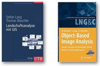
- Blaschke, T., S. Lang & G. Hay (eds.) (2008): Object-Based Image Analysis – Spatial concepts for knowledge-driven remote sensing applications. New York: Springer, 818 pages.
- Lang, S. & T. Blaschke (2007): Landschaftsanalyse mit GIS, UTB-Reihe. – Ulmer Verlag, Stuttgart, 420 pages. [available in German, Portuguese, Croatian]
- Lang, S., Blaschke, T. & Schöpfer, E. (eds.) (2006) 1st International Conference on Object-based Image Analysis (OBIA 2006). International Archives of Photogrammetry, Remote Sensing and Spatial Information Sciences, ISPRS Proceedings
- Book chapters et al. (selection)
- Lang, S., P. Füreder and E. Rogenhofer (in press). Earth observation for humanitarian operations. In: C. Al-Ekabi and S. Ferretti (eds.) Yearbook on Space Policy 2016 “Space for Sustainable Development”, Berlin: Springer.
- Lang, S., T. Blaschke, G. Kothencz and D. Hölbling (2018). Urban green mapping and valuation. In: Q. Weng, D. A. Quattrochi and P. Gamba (eds.) Urban Remote Sensing, Boca Raton: CRC Press pp. 287-308.
- D’Oleire-Oltmanns, S., B. Riedler, L. Pernkopf, E. Weinke & S. Lang (2015) Validation strategy for user-specific map products for the European Copernicus security service. In: A. Car, T. Jekel, J. Strobl and G. Griesebner (eds.) GI_Forum 2015 – Geospatial Minds for Society Vienna: Verlag der Österreichischen Akademie der Wissenschaften, 438-444.
- Füreder, P., S. Lang, M. Hagenlocher, D. Tiede, L. Wendt and E. Rogenhofer (2015) Earth observation and GIS to support humanitarian operations in refugee/IDP camps. In: Palen, Büscher, Comes and Hughes (eds.) Geospatial Data and Geographical Information Science – Proceedings of the ISCRAM 2015 Conference, Kristiansand.
- Lang, S. & P. Füreder (2015) Earth observation for humanitarian operations. In: A. Car, T. Jekel, J. Strobl and G. Griesebner (eds.) GI_Forum 2015 – Geospatial Minds for Society Vienna: Verlag der Österreichischen Akademie der Wissenschaften, 384-390.
- Lang, S., C. Corbane, P. Blonda, K. Pipkins & M. Foerster (2015) Multi-scale habitat mapping and monitoring using satellite data and advanced image analysis techniques In: P. Thenkabail (ed.) Remote Sensing Handbook, New York: Taylor & Francis, 499-525 33.
- Lang, S., P. Füreder, O. Kranz, B. Card, S. Roberts & A. Papp (2015) Humanitarian emergencies: causes, traits and impacts as observed by remote sensing. In: P. Thenkabail (ed.) Remote Sensing Handbook, New York: Taylor and Francis, 483-512.
- Lang, S., S. Kienberger, M. Hagenlocher & L. Pernkopf (2015) Object-based regionalization for policy-oriented partitioning of space. In: P. Thenkabail (ed.) Remote Sensing Handbook, New York: Taylor and Francis, 457-477. 35. Lang, S. and D. Tiede (2015) Geospatial data integration in OBIA – implications of accuracy and validity. In: P. Thenkabail (ed.) Remote Sensing Handbook, New York: Taylor & Francis, 295-316.
- Hagenlocher, M., Kienberger, S., Lang, S. & T. Blaschke, T (2014) Implications of spatial scales and reporting units for the spatial modelling of vulnerability to vector-borne diseases. In: R. Vogler, A. Car, J. Strobl and G. Griesebner, (eds.) GI_Forum 2014. Geospatial Innovation for Society, Berlin: VDE Verlag GmbH, 197-206.
- Lang, S., Corbane, C. & Pernkopf, L. (2013) Earth Observation for Habitat and Biodiversity Monitoring. In: Lang, S. and Pernkopf, L., eds., Ecosystem and biodiversity monitoring: best practice in Europe and globally [section title], GI_Forum 2013 – Creating the GISociety ed., Heidelberg: Wichmann, 478-486.
- Lang, S., Smith, G. & Vanden Borre, J. (2013) Monitoring Natura2000 habitats at local, regional and European scale. In: Ourevitch, S., ed. Discover what GMES can do for European regions and cities, Brussels: SpaceTec Partners, 58-65.
- Lang, S. & Pernkopf, L. (2013) EO-based monitoring of Europe’s most precious habitats inside and outside protected areas. In: Bauch, K., ed. 5th Symposium for Research in Protected Areas, Mittersill: Salzburger Nationalparkfonds, 443 – 448.
- Schöpfer, E., Lang, S. and Strobl, J. (2010) Segmentation and object-based image analysis. In: Jürgens, C. and Rashed, T., eds., Remote sensing of urban and suburban areas, Berlin: Springer, 181-192.
- Kranz, O., S. Lang, D. Tiede, G. Zeug, T. Kemper, M. Caspard, S. Clandillon, S. (2010) GMES Services for Conflict Prevention and Mitigation: Supporting the DG RELEX in Mission Planning. In: Cartography and Geoinformatics for Early Warning and Emergency Management: Towards Better Solutions. Springer, 171-188.
- Ehrlich, D., S. Lang, G. LaNeve, S. Mubareka, S. Schneiderbauer & D. Tiede (2009) Can Earth Observation help to improve the need for information on population? In: B. Jasani, M. Pesaresi, S. Schneiderbauer, G. Zeug (eds.). GMOSS – Global Monitoring for Security and Stability – volume 1. New York: Springer, 211-237.
- Meisner, R., S. Lang, A. Almer, E. Jungert, K. Mertens, R. Göbel, A. de la Cruz, N. Sparwasser, D. Tiede, H. Stelzl, K. Silverarg, T. Blaschke (2009) Data Integration and Visualization for Crisis Applications. In: B. Jasani, M. Pesaresi, S. Schneiderbauer, G. Zeug (eds.) GMOSS – Global Monitoring for Security and Stability – volume 1). New York: Springer, 141-160.
- Lang, S. (2008): Object-based image analysis for remote sensing applications: modeling reality – dealing with complexity. In: Blaschke, T. et al. (eds.): Object-Based Image Analysis – Spatial concepts for knowledge-driven remote sensing applications. New York: Springer, 3-28.
- Lang, S., U. Walz, H. Klug, T. Blaschke & R.U. Syrbe (2008): Landscape metrics ? A toolbox for assessing past, present and future landscape structures. In: Vassilopoulos, A. et al (eds.): Geoinformation Technologies for Geocultural Landscapes: European Perspectives. CRC Press/Balkema (Taylor & Francis Group). Leiden, The Netherlands, pp. 207-234.
- Lang, S., P. Zeil, S. Kienberger & D. Tiede (2008): Geons ? policy-relevant geo-objects for monitoring high-level indicators. In: Car, A. et al. (eds.): Proceedings of GI-Forum Salzburg,: Wichmann: Heidelberg.
- Lang, S., M. Möller, E. Schöpfer, T. Jekel, E. Kloyber & T. Blaschke (2008): Quantifying and qualifying urban green by integrating remote sensing, GIS and social science methods. In: Petrosillo, I. et al. (eds): Use of Landscape Sciences for the Assessment of Environmental Security. Berlin, New York: Springer.
- Lang, S., D. Tiede, J. Schumacher, D. Hölbling (2007): Individual object delineation revising cadastral boundaries by means of VHSR data. In: Remote Sensing for Environmental Monitoring, GIS Applications, and Geology VII conference. Proceedings of SPIE. Florence, CD-ROM.
- Lang, S. & T. Blaschke (2006) Bridging remote sensing and GIS – what are the most supportive pillars? In: Lang, S et al. (eds): Proceedings of the 1st International Conference on Object-based Image Analysis, July 4-5, 2006
- Lang, S., D. Tiede & G. Santilli (2006) Varying sensors and algorithms ? an information delivery approach for population estimation in African refugee camps. In: 6th African Association of Remote Sensing of the Environment Conference (AARSE), Cairo, Egypt.