
Christian Doppler Laboratory for Geospatial and EO-based Humanitarian Technologies
Website: https://geohum.eu/
Technologies at the interface of satellite Earth observation (EO) and geoinformatics (GI) are now widely used to support humanitarian operations.
Background (in German)
Our vision is to enhance technical and organisational capacities matching specific needs from humanitarian non-governmental organisations (NGOs), in particular our partner MSF (Médecins Sans Frontières, Doctors Without Borders).
To optimise aid delivery, we leverage cutting-edge technological advancements at the interface of EO*GI and AI (artificial intelligence).
Envisaged outcomes are a fundamental scientific substantiation and the development and innovative use of relevant information products to optimize logistics and mission planning of MSF in conflict and humanitarian disaster situations.
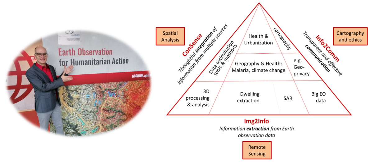
Research Area Img2Info
Methods to extract information from Earth observation data:
- Combining deep learning in convolutional neural networks with object based image analysis (OBIA) to extract buildings and other relevant features from optical satellite images
- Producing 3D models of cities, using cross-track / cross-date stereo data for the estimation of urban population numbers
- Improving the analysis of Radar satellite data for mapping under cloud conditions
- Exploring the potential of big EO data for land cover mapping, flood and fire monitoring, etc.
Research Area ConSense
We combine EO primary data with data and information from other sources, like OpenStreetMap, institutional actors, statistical data etc. We want to develop a toolset for data quality control, data aggregation, spatial regionalization, and validation, which allows us to employ robust data assimilation strategies, resulting in more accurate information products on a high semantic level.
Research Area Info2Comm
Info2Comm is about the communication of scientific results to the recipients and decision makers at the level of MSF operations. Especially for information products, which build upon a multitude of input data, understanding and communicating the uncertainties involved in the production process is fundamental. The best and most sophisticated information product is inappropriate if users do not understand the inherent uncertainties, and therefore cannot make confident decisions based on it.
The use of geospatial data sometimes touches ethical issues of privacy as well. Development of guidelines in this regard is also part of this research.


