Risk, Hazard & Climate Lab
Research Highlights
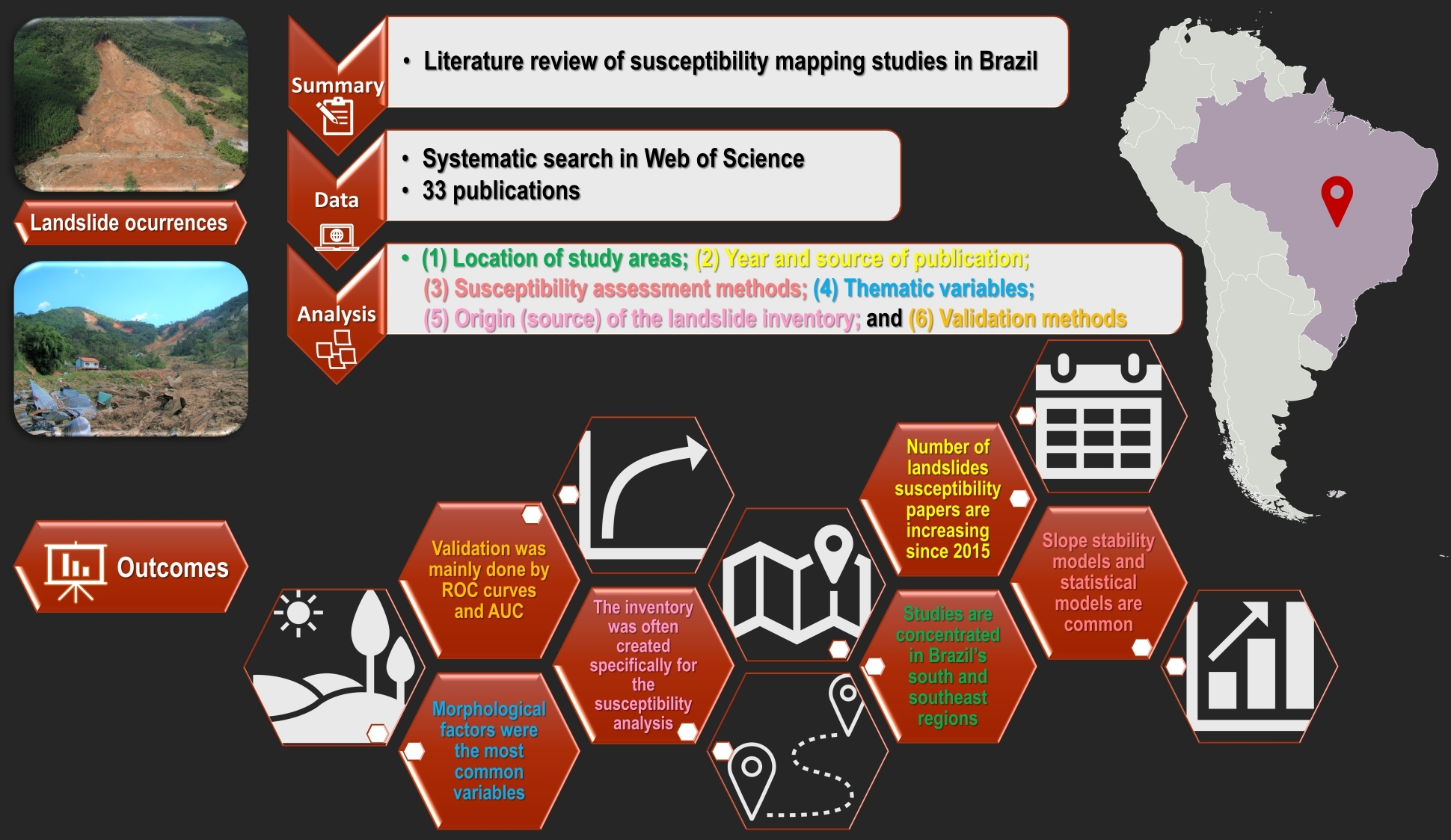
Sustainability
–
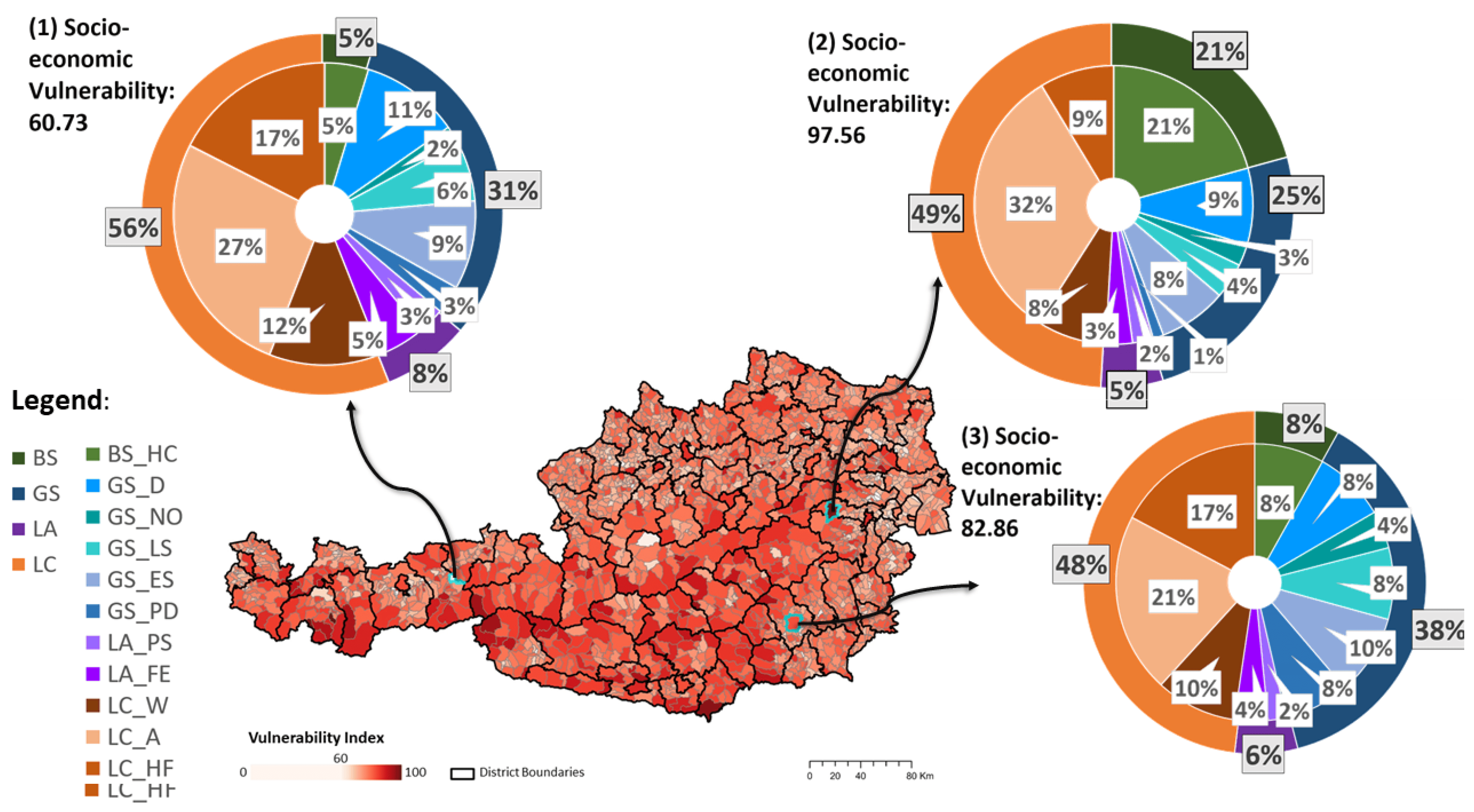
Streifeneder et al. (2024). Socio-Economic Vulnerability Assessment for Supporting a Sustainable Pandemic Management in Austria
Permafrost and Periglacial Processes
–
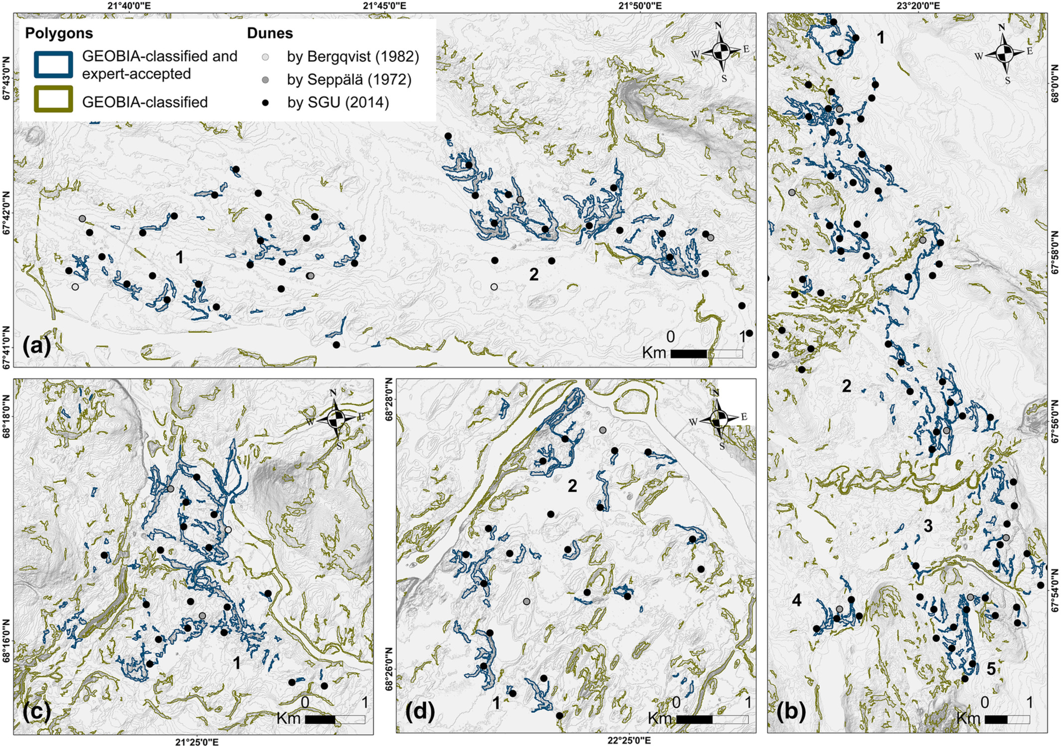
Stammler et al. (2023). Geographic object-based image analysis (GEOBIA) of the distribution and characteristics of aeolian sand dunes in Arctic Sweden
Frontiers in Climate
–
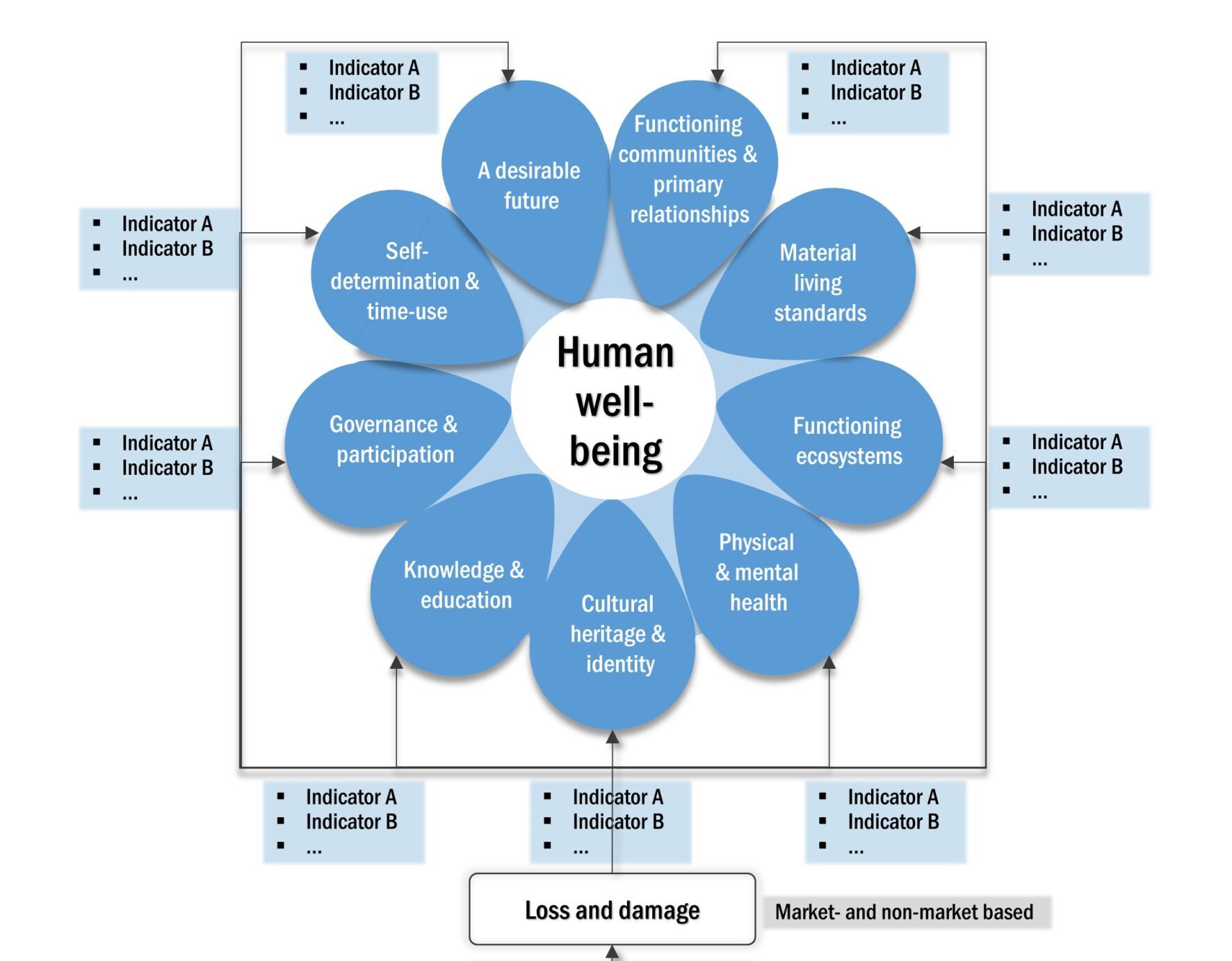
Menk et al. (2022). What's at stake? A human well-being based proposal for assessing risk of loss and damage from climate change
Environmental Research Letters
–
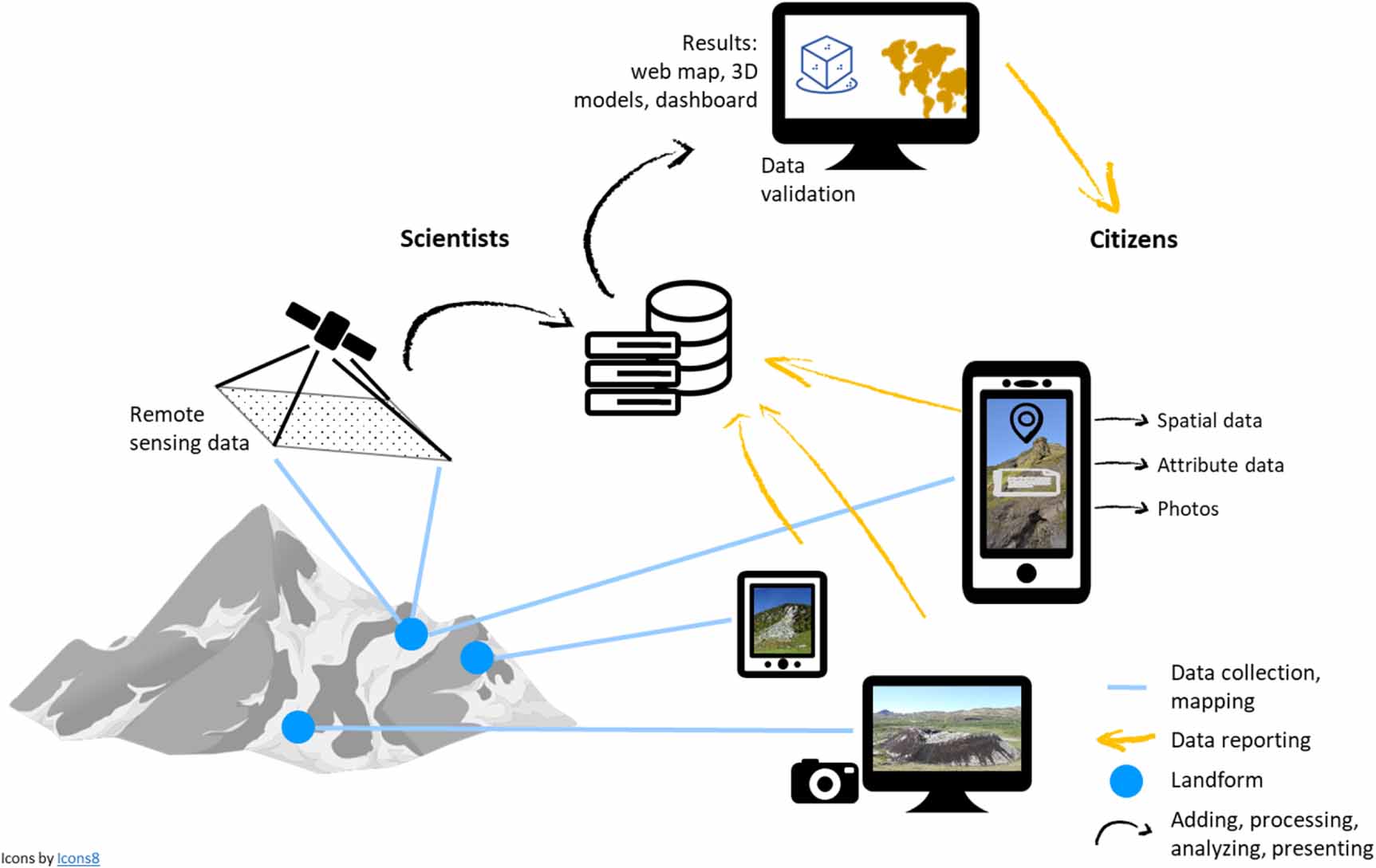
Hennig et al. (2022). Citizen science and geomorphology: the citizenMorph pilot system for observing and reporting data on landforms
Remote Sensing
–
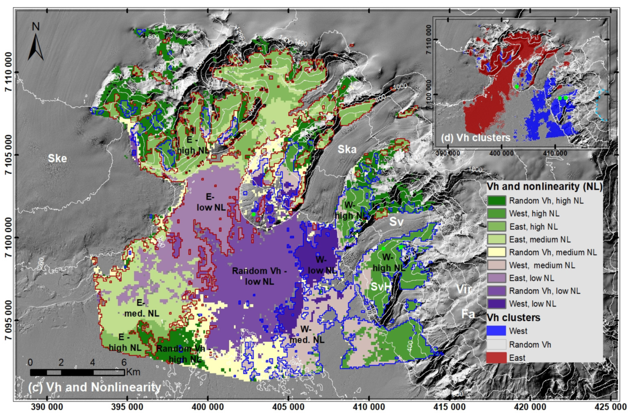
Dittrich et al. (2022). Inferring 2D Local Surface-Deformation Velocities Based on PSI Analysis of Sentinel-1 Data: A Case Study of Öræfajökull…
Weather, Climate, and Society
–
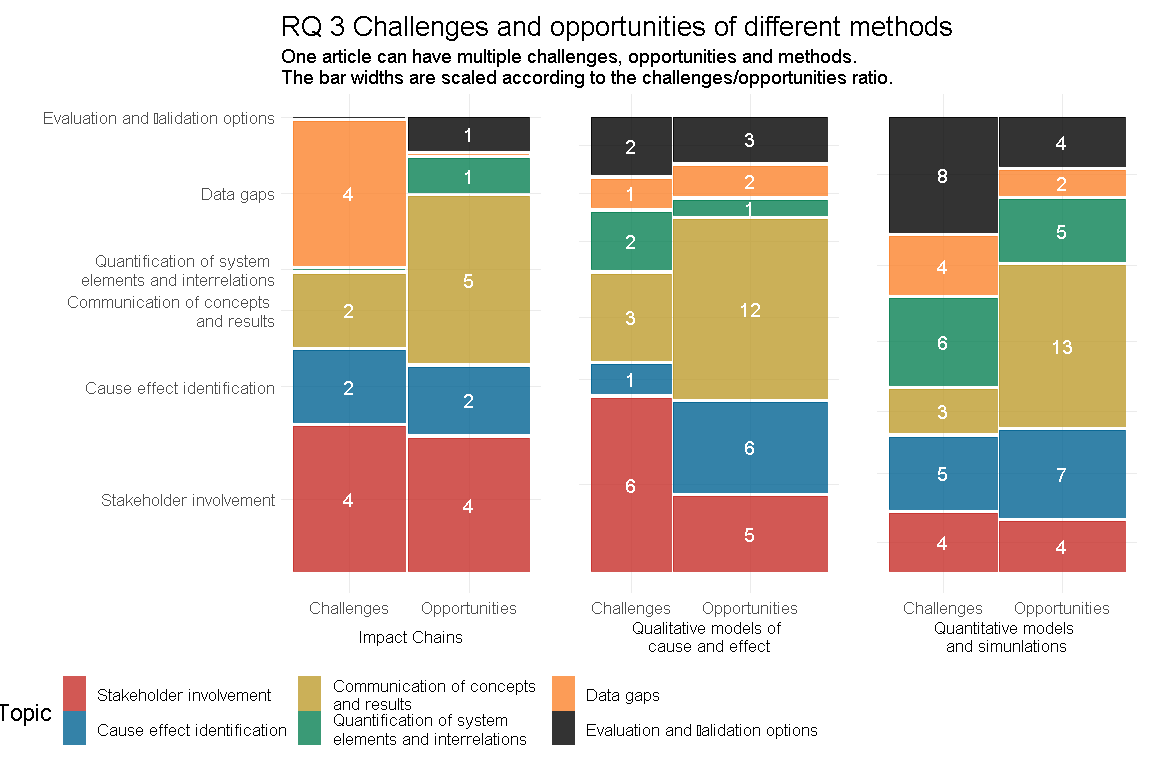
Menk et al. (2022). Climate Change Impact Chains: A Review of Applications, Challenges, and Opportunities for Cimate Risk and Vulnerability…
Int. J. of Disaster Risk Reduction
–
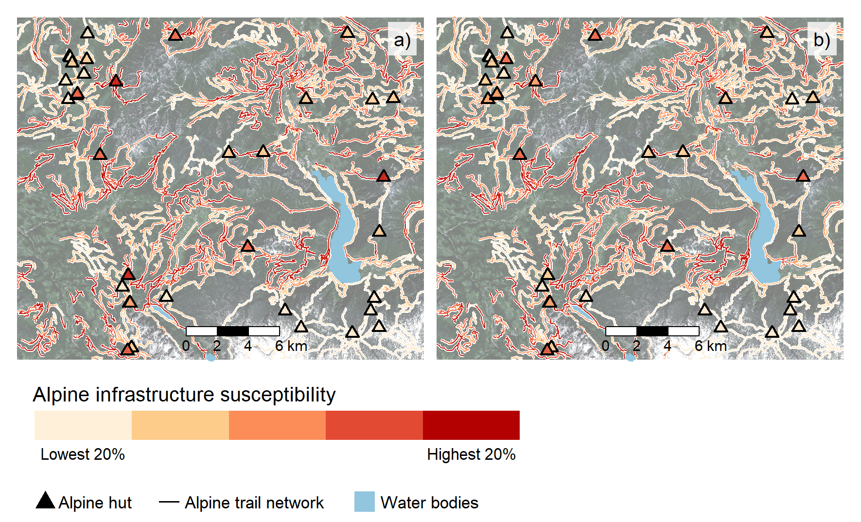
Abad et al. (2022). Mass movement susceptibility assessment of alpine infrastructure in the Salzkammergut area, Austria
gis.Science
–
Hölbling (2022). Data and knowledge integration for object-based landslide mapping – challenges, opportunities and applications
Open Geosciences
–
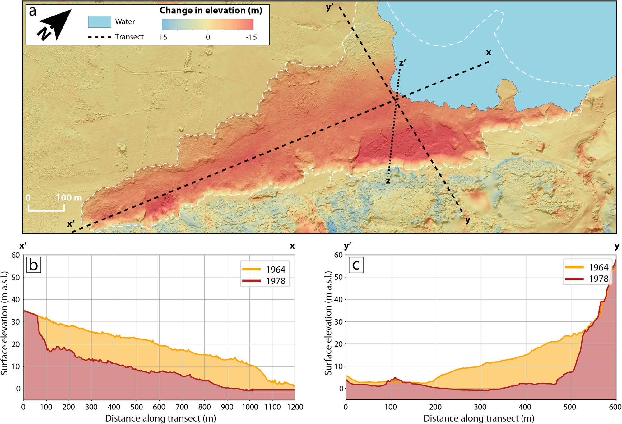
Robson et al. (2022). Estimating the volume of the 1978 Rissa quick clay landslide in Central Norway using historical aerial imagery
Science of the Total Environment
–
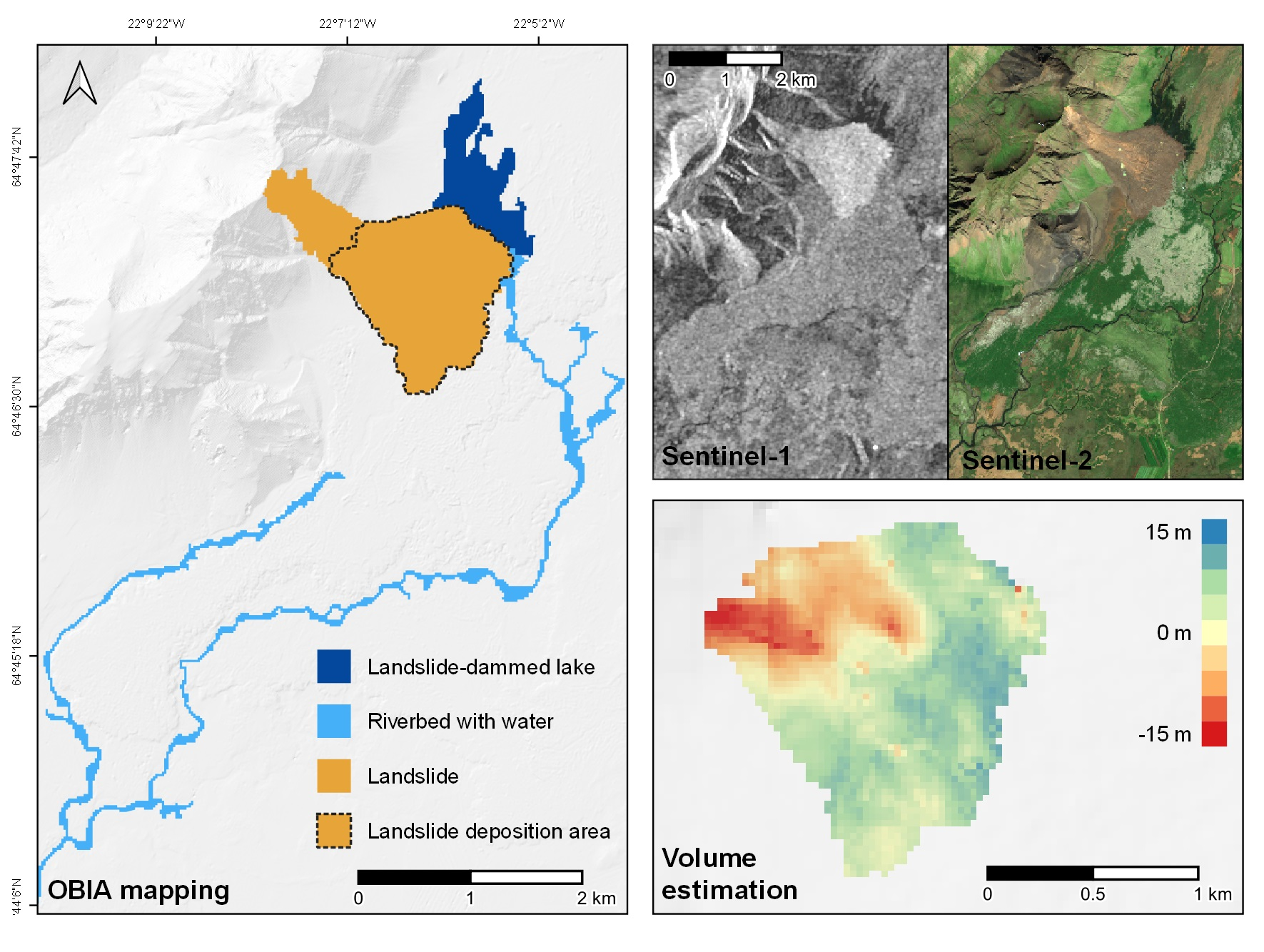
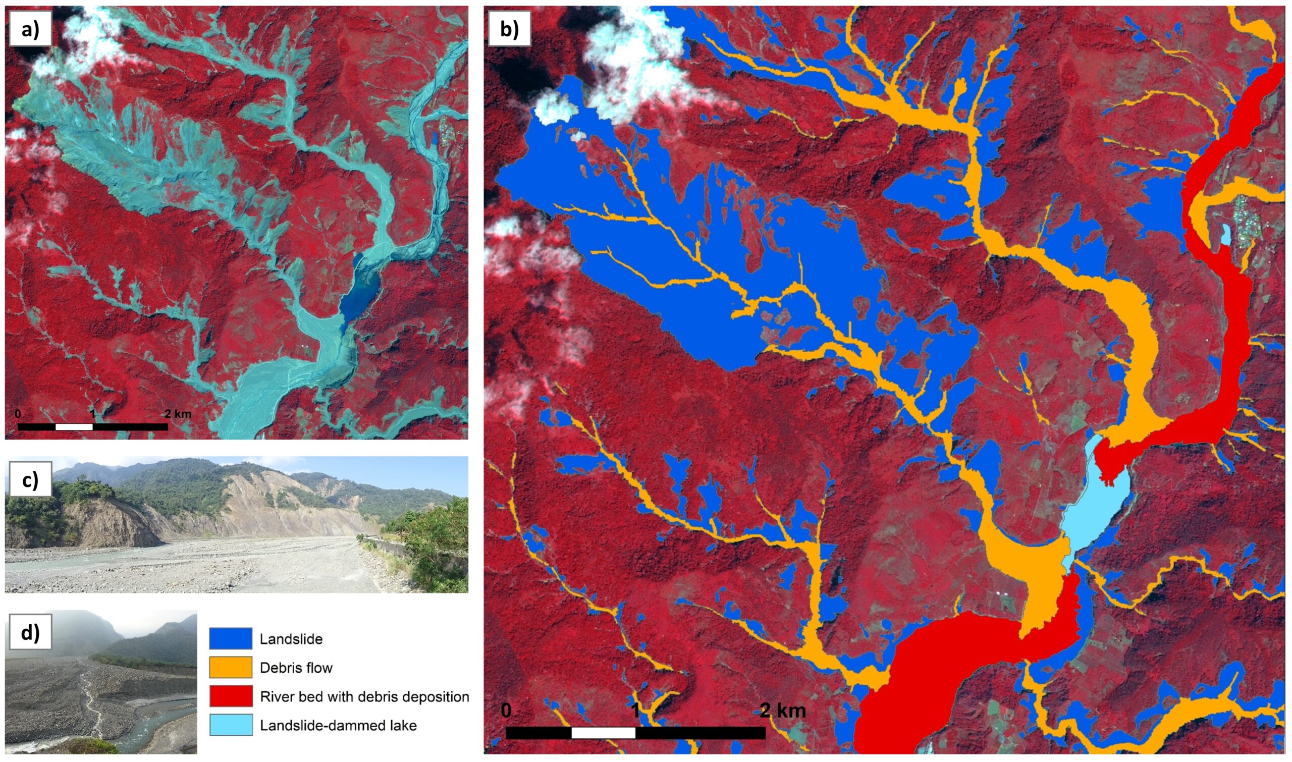
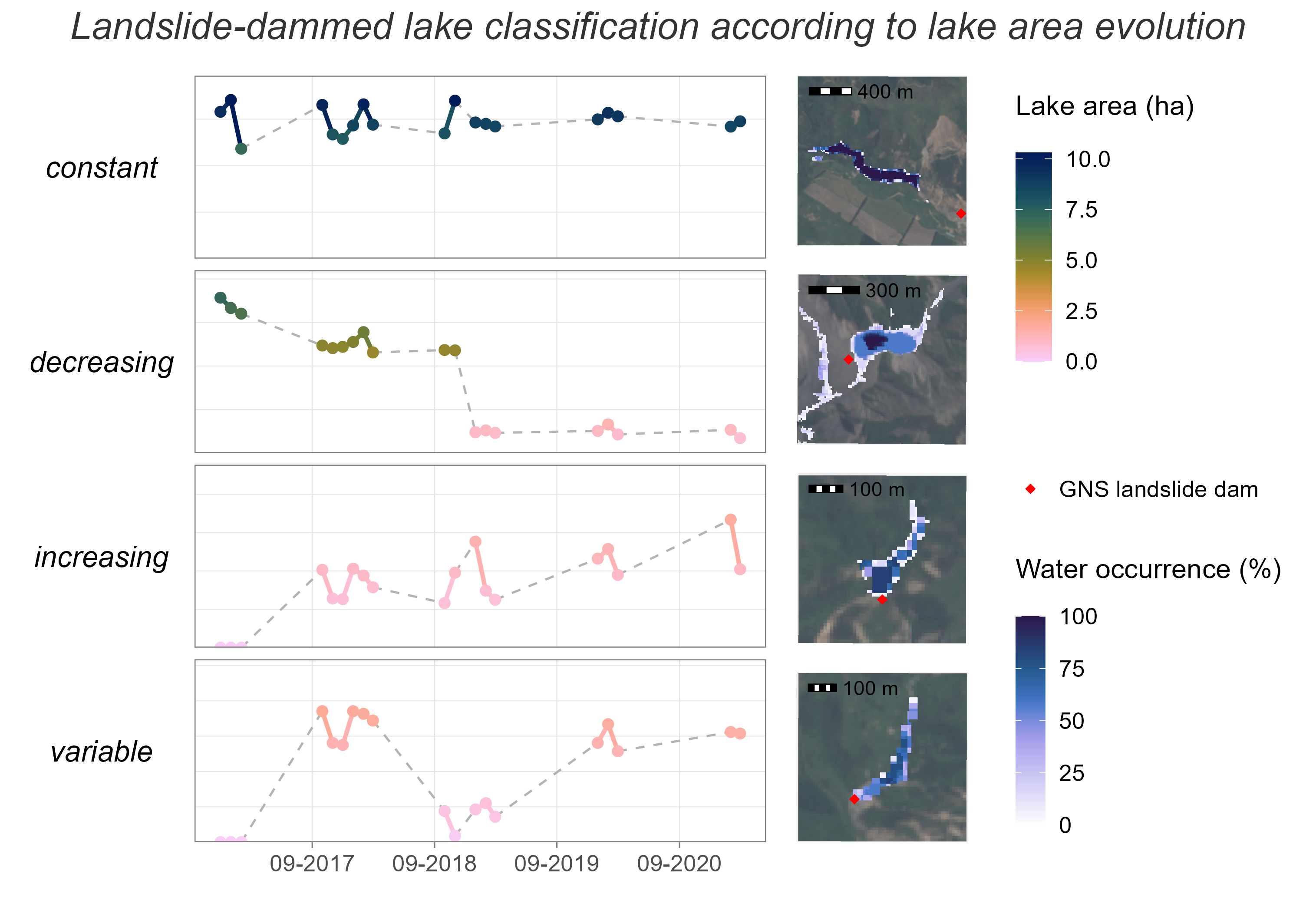
Abad et al. (2022). Detecting landslide-dammed lakes on Sentinel-2 and monitoring their spatio-temporal evolution following the Kaikōura earthquake…
Geosciences
Remote Sensing of Environment
–
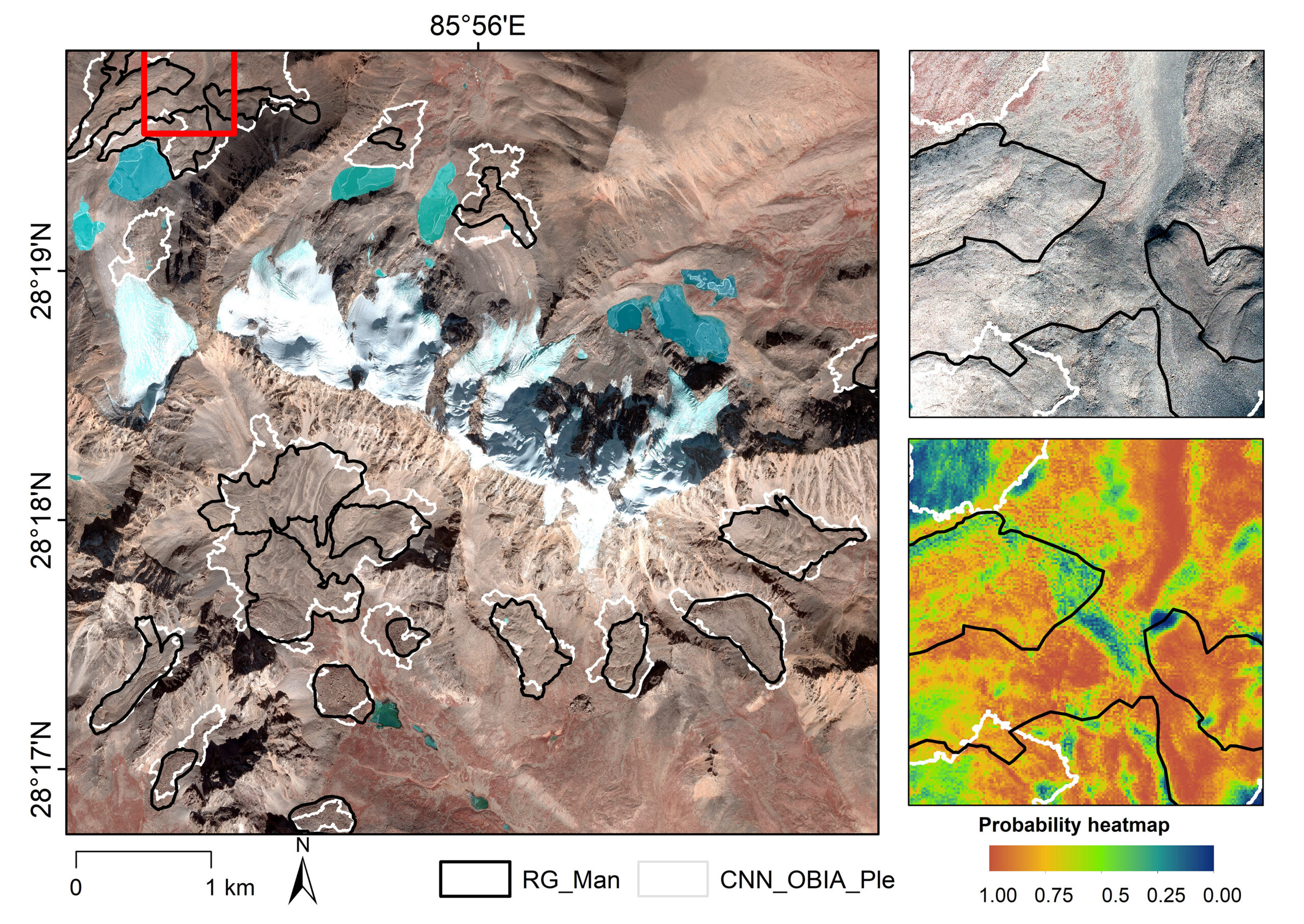
Robson et al. (2020). Automated detection of rock glaciers using deep learning and object-based image analysis
Sustainability
–
Leis & Kienberger (2020). Climate Risk and Vulnerability Assessment of Floods in Austria: Mapping Homogenous Regions, Hotspots and Typologies

Applied Sciences
–
Hölbling et al. (2020). Mapping and Analyzing the Evolution of the Butangbunasi Landslide using Landsat Time Series with Respect to Heavy Rainfall…
Applied Sciences
–
Dabiri et al. (2020). Assessment of Landslide-Induced Geomorphological Changes in Hítardalur Valley, Iceland, Using Sentinel-1 and Sentinel-2 Data